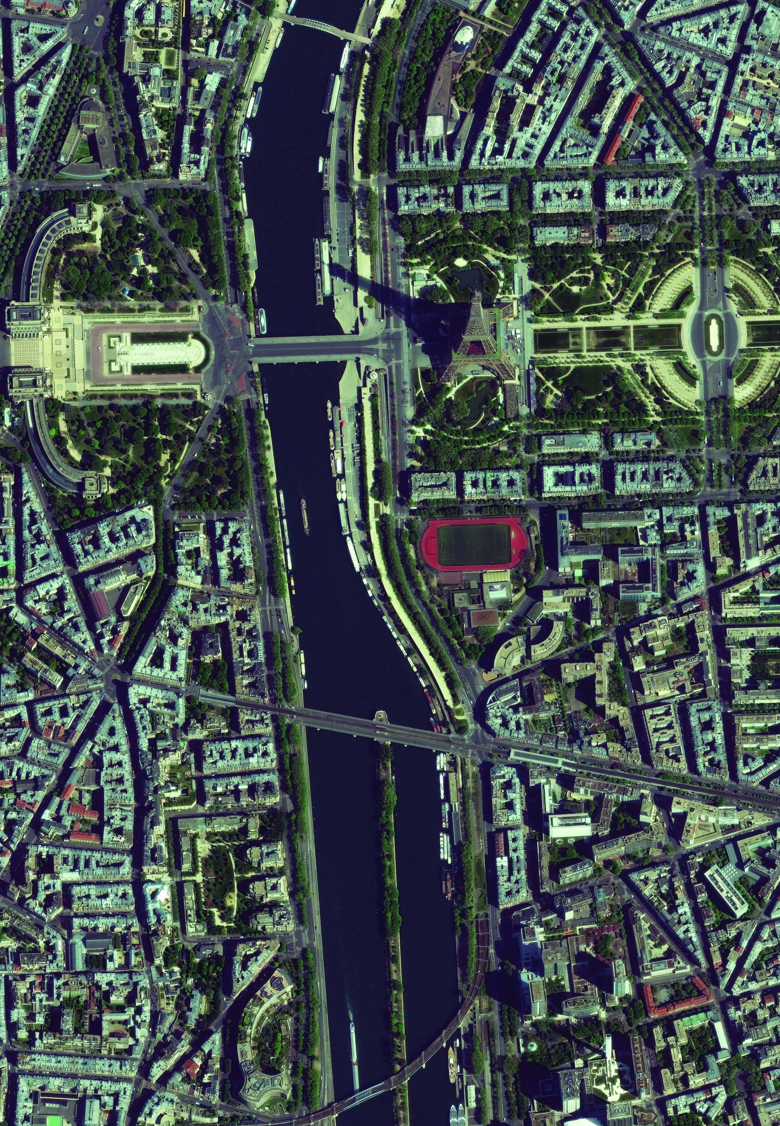
Seeing through the Trees: Monitoring Agriculture and Forestry with Satellite Imagery
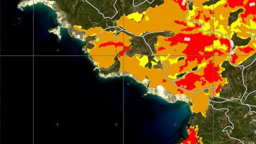
There is a strong requirement for near real-time monitoring forests and crops in order to tackle the...

Since the launch of the first Very High Resolution commercial satellite, European Space Imaging has been providing the best possible spatial resolution to the European market. From our inception in 2002, we have established and maintained strong relationships with the industries premium satellite imagery leaders and this has allowed us to ensure that we stay at the forefront of the geospatial industry.
With almost 20 years’ experience, European Space Imaging has developed a reputation for expert and personalised customer service and an unbeatable track record for supplying tailored very high resolution imagery solutions to meet the diverse projects and requirements of their customers.
Furthermore, European Space Imaging is the only European satellite data provider to supply imagery at true 30 cm resolution and who own and operate its own multi-mission ground station for direct satellite tasking and local data downlink.
Through our long-standing partnership with Maxar Technologies, we have direct access to the WorldView constellation, the World’s best satellites in terms of spatial resolution. From our ground station at the German Aerospace Centre (DLR) our expert operations staff directly access the satellites as they pass over Europe and North Africa. Utilising optimised and flexible collection planning, we can confidently guarantee the best possible image in terms of clarity, and always with 15% cloud cover or less. The WorldView constellation collects over 3 million square kilometres of data per day and can cover approximately 60% of the Earth’s surface monthly with intraday revisits.
Expanding our satellite portfolio to extend beyond just that of Very High Resolution, we recently entered into a partnership with Satellogic and have access to their entire satellite portfolio, including their Aleph-1 constellation, delivering 0.7 m and beyond spatial resolution satellite imagery in both multispectral and hyperspectral. The Aleph-1 constellation can collect more than 4 million square kilometres per day and has a revisit rate of 4 times per day.
Through these innovative partnerships, European Space Imaging now has access to 25 orbiting satellites at resolutions of 30 cm – 1 m and with a combined daily revisit of close to 10 times per day. In addition, we have access to an extensive imagery archive incorporating billions of square kilometres of dating from all over the world dating back as far as 2000.
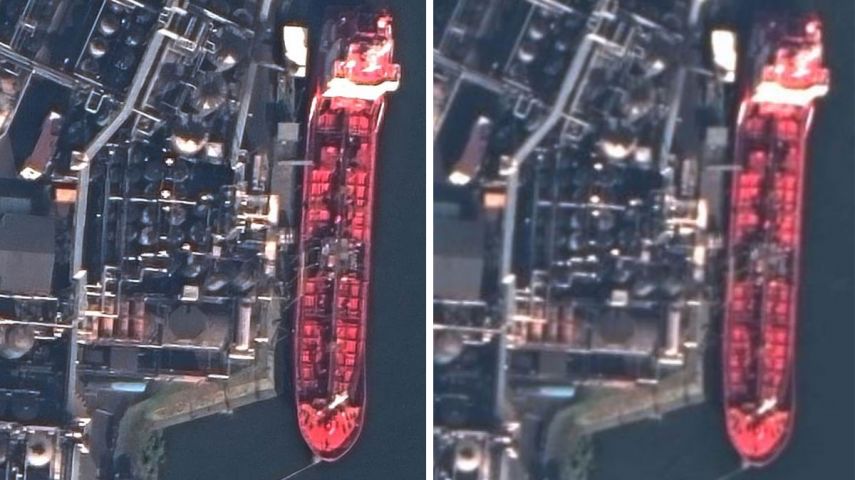
When your organisation’s business decisions require you to identify small features on the ground, an improved visual experience is key. The identification of objects such as road lines, individual plants, building edges and vehicles often requires the highest level of visual clarity. True 30 cm resolution imagery has long been the industry leader in clarity. Now with innovative proprietary technology applied to native 30 cm data, 15 cm HD imagery provides the next level of detail – enhancing manual and automated feature extraction efforts from satellite imagery.
15 cm HD is achieved through a process that intelligently increases the number of pixels in a native 30 cm resolution image, resulting in an improved visual experience. Not limited to any certain resolution, HD technology can also be applied to native 40-60 cm imagery, rendering a 30 cm HD image and thus, increasing the availability of 30 cm resolution imagery across the historical archive.
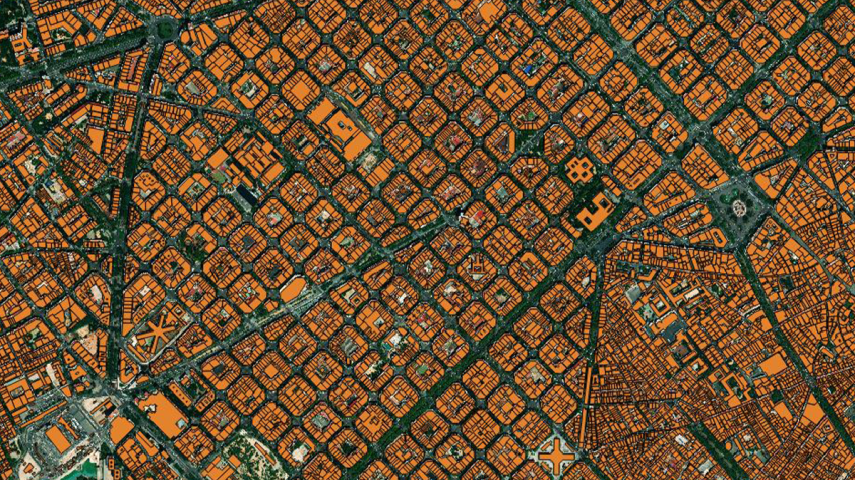
Ecopia Global Feature Extraction (GFX) Powered by European Space Imaging is a unique partnership that utilises the freshest, highest quality satellite imagery along with the most advanced artificial intelligence from Ecopia.AI (Ecopia) to offer accurate geospatial feature extraction at continent-wide scale. The product comes with up to 12 core features eligible for extraction, so users can receive comprehensive land cover maps with zero in-house GIS work. The resulting vector maps are delivered as easy-to-use shapefiles, enabling users to focus on necessary analytics rather than time consuming map making.
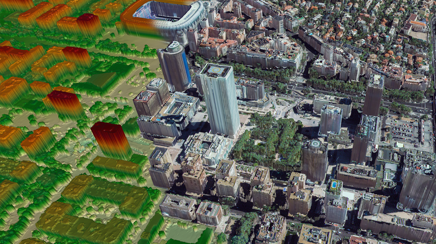
European Space Imaging has partnered with GAF AG to create RapidDEM, a revolutionary elevation product. With RapidDEM, users can get fresh Very High Resolution (VHR) Digital Elevation Models (DEM) delivered 24 hours after collection. Utilising a sophisticated method whereby five VHR images are collected from varying angles on a single satellite pass, European Space Imaging is able to provide incredibly accurate elevation data and the highest quality 30 cm resolution textures to GAF AG, who then builds the 3D model and rush delivers it to the end user.
The ability to deliver up-to-date elevation models has high impact applications for:
GEOINT
Fresh 3D models of critical areas for mission planning and rapid decision making
Construction/infrastructure Planning
When elevation data is old or missing during the site selection process
Emergency Management
Post-event 3D models for landslides, earthquakes or mountainous terrain delivered in time for response crews to utilise


There is a strong requirement for near real-time monitoring forests and crops in order to tackle the...

No statistics could possibly convey the importance of energy to our economies and everyday lives. Ne...

It is estimated that 55% of the world’s population lives in urban areas. This number is expect...

The ocean is a precious resource that all Europeans make use of in one way or another. Over 200 mill...
This site uses cookies. By continuing to use this website, you agree to our Cookies Policy. Agree