5 Questions to… Christoph Strecha (Pix4D)
Dr Christoph Strecha is the CEO and founder of Pix4D, a Swiss company which develops and markets sof...

Pix4D photogrammetry software allows the mapping of medium to large areas faster, saving a lot of time and facilitating the acceptance of more contracts with the same internal resources.
Add ground control points and checkpoints to control and assess the accuracy of your results with a dedicated quality report.
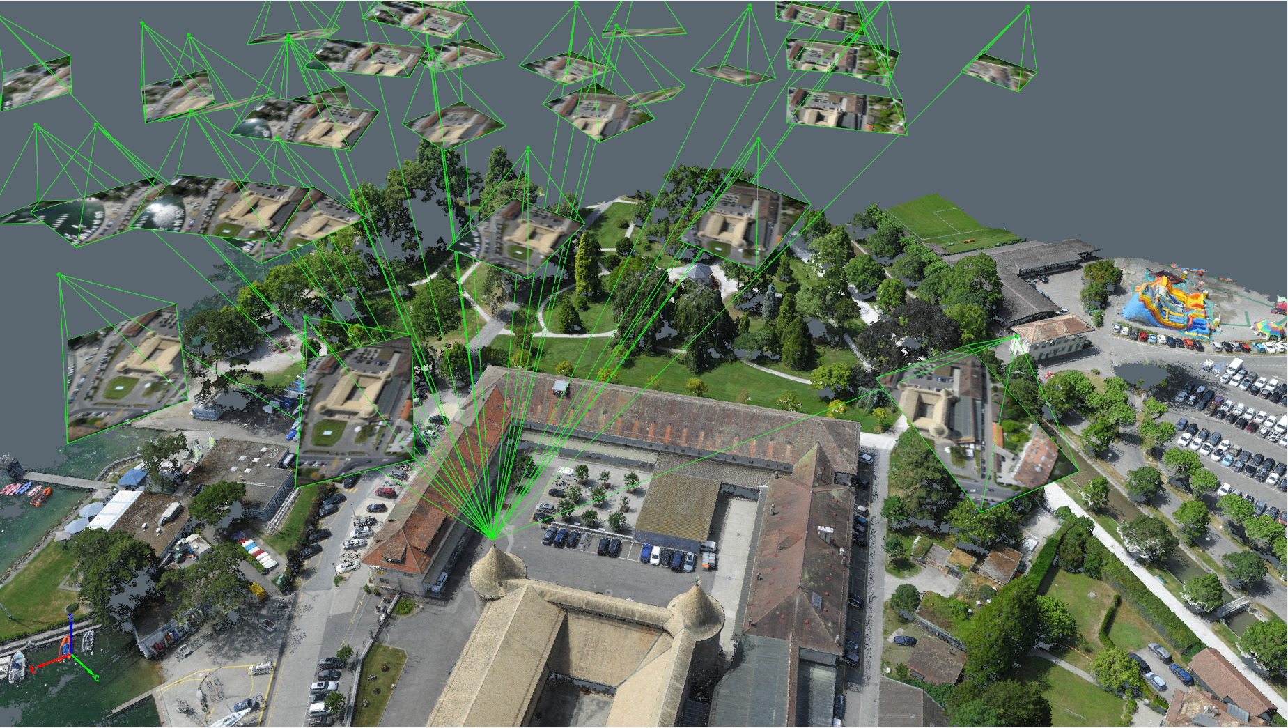
Visually verify and improve the accuracy of your project with Pix4D’s unique rayCloudTM environment. It connects your original images to each point of the 3D reconstruction, allowing virtual inspection from anywhere.
Get your data from a safe place. With drone mapping, there's no need to climb on stockpiles, get near to cliffs, on a busy road or walk through rough terrain.
Because of a simple workflow and easily repeatable data capture, maps and models can be easily updated as often as required. Provide daily, weekly or monthly updates of your area of interest at a fraction of the expense.

Dr Christoph Strecha is the CEO and founder of Pix4D, a Swiss company which develops and markets sof...

Swiss engineering and geomatics consulting firm Mosini Caviezel SA has been testing terrestrial phot...

WaldoAir, USA, and Pix4D, Switzerland, have announced the launch of an integrated camera system for...

PIX4Dsurvey cuts out the steps between photogrammetry and CAD, allowing you to extract only the most critical vector data information from point clouds of any s...

PIX4Dmapper is the photogrammetry software of choice for thousands of professionals, it has proven to be flexible, powerful, and precise. Get a range of outputs...

PIX4Dcloud is the online platform for drone mapping, progress tracking, and site documentation. Analyse your projects with ease, and access them anywhere in the...

PIX4Dfields is the software solution for modern agriculture. Use this product to implement precision agriculture, which means short processing times that produc...

PIX4Dcatch is the mobile photogrammetry app, turning mobile devices into powerful 3D scanners, taking advantage of new Lidar capabilities in phones (when availa...
This site uses cookies. By continuing to use this website, you agree to our Cookies Policy. Agree