French Firm Gains Time and Data Precision with Trimble MX50 and X7 Hardware
Complementary and Consistent: Duo of Trimble MX50 and X7 Saves French Company Time Capturing Precise...

Trimble Geospatial provides solutions that facilitate high-quality, productive workflows and information exchange, driving value for a global and diverse customer base of surveyors, engineering and GIS service companies, governments, utilities and transportation authorities. Trimble’s innovative technologies include integrated sensors, field applications, real-time communications and office software for processing, modelling and data analytics.
Using Trimble solutions, organizations can capture the most accurate spatial data and transform it into intelligence to deliver increased productivity and improved decision-making. Whether enabling more efficient use of natural resources or enhancing the performance and lifecycle of civil infrastructure, timely and reliable geospatial information is at the core of Trimble’s solutions to transform the way work is done.

Complementary and Consistent: Duo of Trimble MX50 and X7 Saves French Company Time Capturing Precise...

A Norwegian civil engineering construction company is using 3D scanning to survey two critical under...

Take control of the way you work. Scanning, imaging, processing, and sharing at speed and scale. Tri...

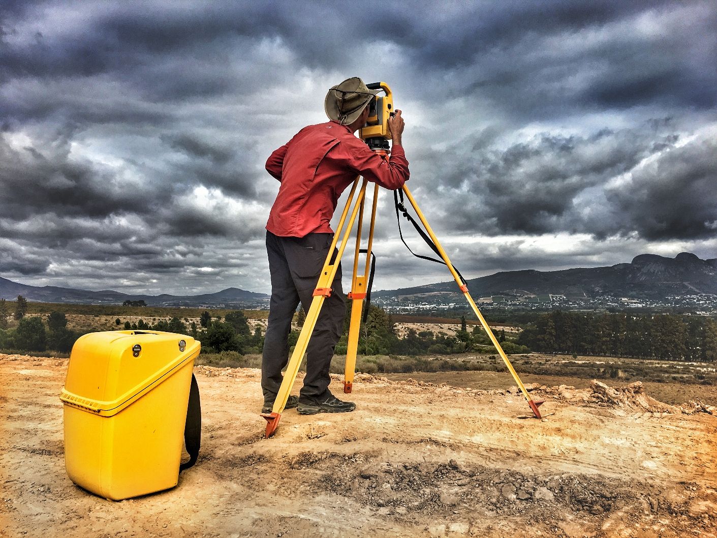
During the early days of Global Positioning System (GPS) technology in the 1980s and 1990s, surveyor...
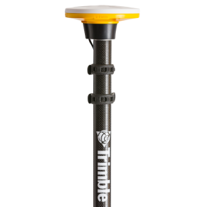
It incorporates Inertial Measurement Unit (IMU)-based tilt compensation using Trimble TIP technology which enables points to be measured or staked out quickly a...
For rail construction or asset management projects, the Trimble® MX9 system is part of a complete field-to-finish mobile mapping solution that combines state-of...
Bekijk eenvoudig productinformatie en toepassingen van de Trimble S9 en neem eenvoudig contact op met de juiste leverancier
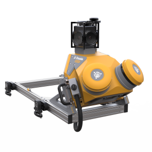
The Trimble MX50 typically mounts on the roof of a vehicle and captures Lidar and panoramic imagery at highway speeds. The system employs accurate Lidar technol...
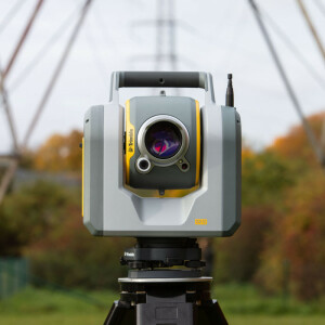
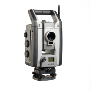
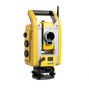
The Trimble SX12 is the one instrument you need to handle any survey project by integrating surveying, imaging, and 3D scanning capabilities into your everyday...
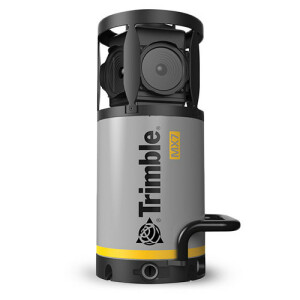
The Trimble MX7 mobile imaging solution allows you to capture environmental data for a complete job site or project area in a single site visit. Decision-makers...

Trimble Business Center (TBC) is an office survey and construction CAD software that integrates data from multiple sensors, Trimble or third-party. Bring digita...
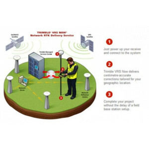
VRS Now™ provides instant access to real-time kinematic (RTK) corrections utilizing a network of permanent (fixed) continuously operating reference stations.
Trimble® Catalyst™ is a revolutionary GNSS concept delivering positioning-as-a-service to iOS and Android™ devices. With the addition of the simple, lightweight...
Trimble MX software is a powerful solution which allows managing mobile mapping content, extract features, perform measurements and collaborate with stakeholder...
Trimble eCognition Suite is an advanced image analysis software available for geospatial applications. It is designed to improve, accelerate, and automate the i...
Bekijk eenvoudig productinformatie en toepassingen van de eCognition Essentials en neem eenvoudig contact op met de juiste leverancier
Bekijk eenvoudig productinformatie en toepassingen van de Trimble S5 en neem eenvoudig contact op met de juiste leverancier
The Trimble Access software suite offers surveyors and geospatial professionals a range of specialized field applications designed to make fieldwork easier. Wit...
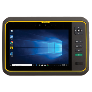
The Trimble® T7 tablet is purpose-built for demanding survey and GIS applications. Featuring a powerful processor, Windows® 10 OS, large memory and a modern use...
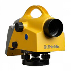
Bekijk eenvoudig productinformatie en toepassingen van de Trimble DiNi level en neem eenvoudig contact op met de juiste leverancier
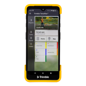
Trimble® TerraFlex® software is a flexible and easy-to-use cloud-based solution for field data collection. TerraFlex enables you to create a set of digital form...
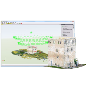
Generate imaging point clouds as a cost-effective alternative to laser scans, benefit from detailed images to acquire GIS data and transfer most of your survey...
The Trimble SX12 is the one instrument you need to handle any survey project by integrating surveying, imaging, and 3D scanning capabilities into your everyday...
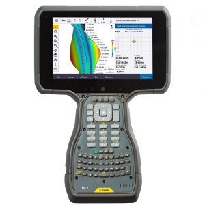
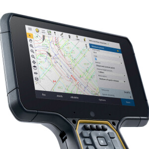
The Trimble® TSC7 controller combines the best of a tablet, laptop and rugged field controller. This versatile and powerful device delivers the latest in field...
This site uses cookies. By continuing to use this website, you agree to our Cookies Policy. Agree