YellowScan: Complete Lidar Solutions, the French Way
The city of Carcassonne in the south of France hopes to obtain UNESCO World Heritage certification f...
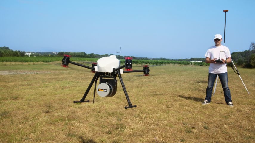
At YellowScan, we design, develop and build Lidar solutions for professionals that require performance, robustness and accuracy. Our hardware and software solutions are easy-to-use data collection tools that come with training and support from our experts.
Founded in 2012 in the South of France, we now have sales, customer training and support representatives around the globe. Our products are used worldwide in surveying, forestry, environmental research, archaeology, industrial inspection, civil engineering, mining and more.
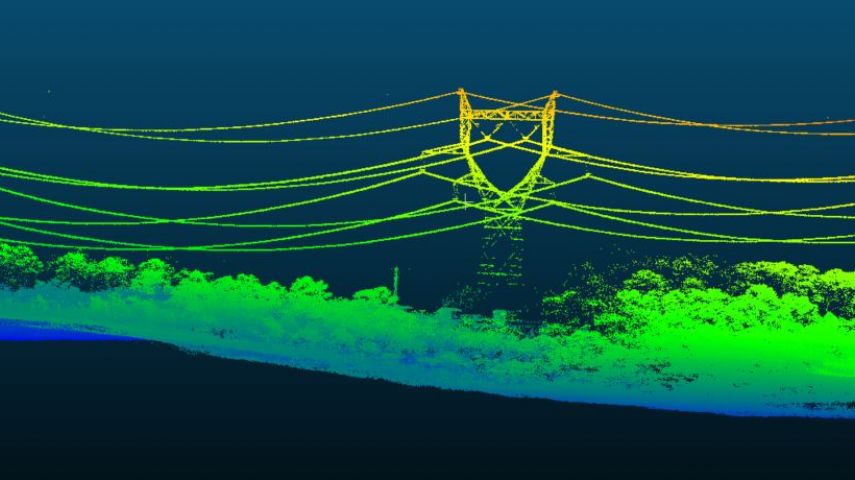
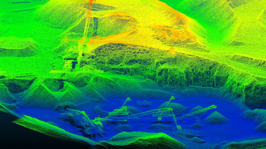
Our products come with embedded laser scanners, INS, GNSS receivers, and onboard computing. Each system is designed to meet the highest precision and accuracy needs for 3D mapping.
Our ecosystem is based on three pillars: the first being our compact turnkey hardware with embedded batteries that are designed, built, and supplied ready to operate.
The second is our proprietary software, the YellowScan CloudStation, with its user friendly and evolving interface.
And the third is our committed technical experts that deliver complete training sessions to customers upon receiving their systems, as well as a 1-year unlimited technical support to enable our customers to confidently undertake their projects, whether they are new or experienced in the field.
Need help selecting a Lidar solution that best fits your needs? Please get in touch for a proof of concept tailored to your unique requirements.
Precision meets reality.

Complete more mission profiles with the YellowScan Voyager.
The Voyager’s 100° laser scanner with its extremely fast data acquisition rate of up to 1800 kHz, makes this solution the best option for projects requiring the highest point density.
More information: Voyager long-range Lidar solution
Versatility at its finest.

Years of research for a unique product.
The Explorer is the first compact, versatile and long-range platform on the market. It is the culmination of several years of research and development done by YellowScan, while closely working alongside customers and partners from around the world.
More information: Explorer long-range Lidar solution
Small and compact. Mighty and powerful.

Advanced performance fitted into a compact survey solution.
The YellowScan Mapper+ is the lightest three echoes and high-density Lidar system.
More information: Mapper+ UAV Lidar
Jump into the Lidar revolution.

Easy mapping redefined.
Start your Lidar journey with our easy-to-use Mapper system. Its low weight, mid-range capability, top-end point density and advanced accuracy and precision, makes this Lidar system the best value for money.
More information: Mapper UAV Lidar
Affordability. Flexibility. Productivity.

With its 360° field of view, the YellowScan Surveyor Ultra answers vertical mapping and mobile mapping needs when combined with Fly&Drive. You can expect unparalleled vegetation penetration thanks to this system’s 32 laser beams.
More information: Surveyor Ultra UAV Lidar
Made for adventurers.

The YellowScan Vx15-100 is a long-range, high-precision UAV Lidar mapping solution, incorporating a Riegl Mini-VUX-1UAV Lidar sensor and an Applanix APX-15 UAV GNSS-Inertial system for highly accurate pointcloud production.
More information: VX15-100 UAV Lidar
The High-end Vx20 series made for professionals.

The Vx20 series is the ideal solution for high-flight projects with quick data processing needs. It is the most accurate system of the Vx series.
More information: VX20-300 high accuracy UAV Lidar

Turn physical projects into digital realities.
The CloudStation is an evolutive and user-friendly software, developed by YellowScan, to generate and visualize pointclouds.
Auto-generation of strips and the production of LAS files can be performed in just a few clicks, providing a faster workflow and enhanced productivity. Advanced visualization tools include 3D viewing, EDL filtering and vertical slicing.
CloudStation also includes a number of optional modules:
More Information: CloudStation

The city of Carcassonne in the south of France hopes to obtain UNESCO World Heritage certification f...

Attendees of YellowScan's recent Lidar for Drone 2022 Conference headed home with a backpack full of...

Find detailed technical information about the LiveStation - Live monitoring software for UAV and Mobile LiDAR data acquisition and view brochures, videos and ca...

Find detailed technical information about the YellowScan CloudStation - Visualization and LiDAR processing software and view brochures, videos and case studies...

The YellowScan Fly & Drive is a versatile land vehicle-mounted or UAV-mounted mobile mapping system. It combines high-resolution laser scanning and precise posi...

YellowScan Vx-20 is the most accurate fully integrated system from YellowScan’s product range. It can fly up to 100m while maintaining accuracy throughout the...

YellowScan Vx-15 is the lightest system integrating the Riegl Mini-VUX. ldeally suited for high precision surveys such as civil engineering. Coupled with the...

Geo-matching connects buyers and suppliers of geospatial software and equipment. Simplify your search, compare specs, and unlock key industry insights with our...

The YellowScan Voyager is a powerful solution for both manned and unmanned aircraft. The laser scanner’s specs can be personalized to fit your different project...

The Surveyor Ultra is suited for high-speed UAVs & long-range needs with its high-density specs. Its lightweight makes it also easy to mount on any drone, inclu...

The YellowScan Mapper UAV Lidar system is equipped with a high-performance Livox Horizon laser scanner from Livox, a DJI-backed company. With a great point dens...

The YellowScan Mapper+ integrates Livox AVIA laser scanner together with high performance GNSS-aided inertial navigation system into a lightweight, standalone a...
This site uses cookies. By continuing to use this website, you agree to our Cookies Policy. Agree