3D computer Models Help Map Wind Flows
Computer-generated 3D city models from Bluesky are helping Mott MacDonald deliver safe, sustainable and user-friendly civil infrastructure projects. The models are being used by the worldwide consultancy to give a better understanding of the wind environment around urban infrastructure projects. By creating complex engineering models Mott MacDonald simulates the flow of wind around a site and creates different scenarios based on the project design.
Mott MacDonald process the Bluesky data first using Pointools' Rhino 3D design software for CAD (Computer Aided Design) to add or remove structures based on the project design and then using specialist software for surface modelling, analysis and visualisation. Having created an airtight envelope around the modelled project area the wind flow is calculated using ANSYS CFX and different design scenarios can be considered.
The company is involved in a number of high-profile infrastructure projects and it is essential that new buildings and redevelopments provide a safe and comfortable experience for all users. The Bluesky data helps to look at different alternatives for access and the use of outside space and amenity areas based on the behaviour of the wind.
Already used by Mott MacDonald for projects in both England and Ireland, Bluesky Building Models are available for most UK cities with a population over 100,000 including London, Edinburgh, Cardiff and Belfast as well as Brighton, Nottingham, Newcastle, Glasgow, Bristol and Cambridge.
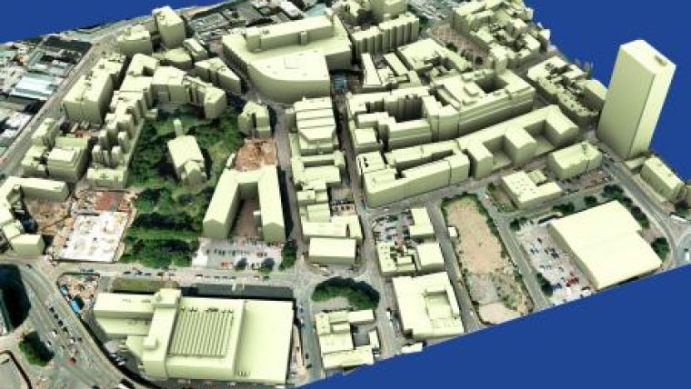
Created from the most up to date, high-resolution, stereo aerial photography Bluesky 3D city models map every building over 140 cubic metres. Accurate to +/- 60cm the Bluesky city models also include road detail and an underlying Digital Terrain Map (DTM) to place the urban representation in its true-world context. The standard Bluesky 3D city model can be enhanced with the addition of vertical, oblique or ground photography to deliver additional detail and real world visual impact.

Value staying current with geomatics?
Stay on the map with our expertly curated newsletters.
We provide educational insights, industry updates, and inspiring stories to help you learn, grow, and reach your full potential in your field. Don't miss out - subscribe today and ensure you're always informed, educated, and inspired.
Choose your newsletter(s)


