3D Interactive Maps to Help Cities Visualise the Future
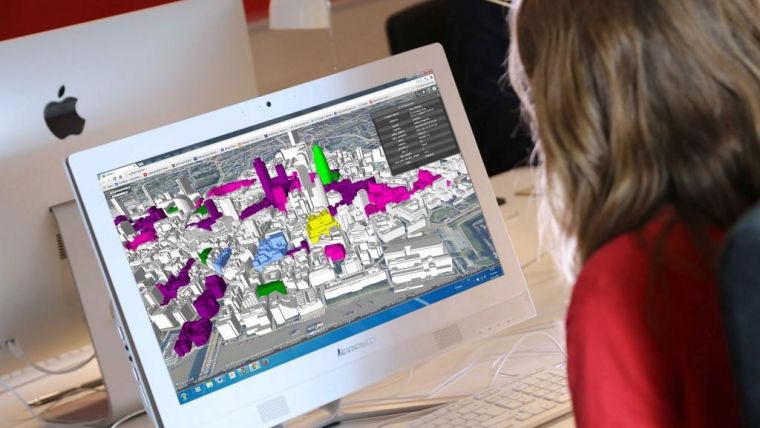
CyberCity 3D, a smart 3D building expert, has developed a 3D Smart Cities mapping platform to help municipal authorities and planners visualise their towns and cities in 3D. Existing and future city plans, proposed developments and schemes, can all be visualised together with relevant data using a simple, out-of-the-box solution, with streaming to any web connected device.
The CyberCity 3D Smart City maps can be used for a host of applications including planning, transport, environment and tourism. The models are fully interoperable and will perform on most proprietary software applications such as GIS and 3D design packages and can be streamed via the web. The live streaming uses Cesium open architecture, a cross-platform virtual globe designed for dynamic-data visualisation, allowing the 3D models to be viewed on tablets, phones, desktops and laptops.
Building models
CyberCity 3D employs patented 3D modelling process to generate high resolution building models from stereo imagery. The smart buildings automatically contain valuable measurement data, such as height and roof slope, with up to 12.5cm accuracy. Cities across the world have already employed CyberCity 3D technology to support work such as urban planning, economic development, flood risk assessment, transportation planning and line of sight studies.
In the UK, CyberCity 3D has teamed up with aerial mapping company Bluesky who provide a huge data library covering 150,000 square kilomtres of digital aerial photography, allowing CyberCity 3D to gain access to urban centres across the UK for 3D modelling. CyberCity 3D also has access to Bluesky’s National Tree Map, a digital map detailing more than 300 million trees across the UK, which adds a useful dimension to the 3D Smart City projects.
Library
CyberCity 3D has a large smart 3D GIS building library, covering more than 80 cities around the world. Applications include master planning and proposed construction maps, stakeholder, management, engagement & communication, flood analysis visualisation, leisure and tourism. CyberCity 3D data is also used in applications such as 3D gaming and augmented reality.

Value staying current with geomatics?
Stay on the map with our expertly curated newsletters.
We provide educational insights, industry updates, and inspiring stories to help you learn, grow, and reach your full potential in your field. Don't miss out - subscribe today and ensure you're always informed, educated, and inspired.
Choose your newsletter(s)


