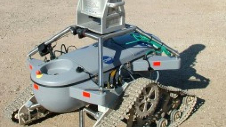
3D Laser Mapping Develops Laser Scanning Robot
3D Laser Mapping (United Kingdom) has developed a laser-scanning robot to provide an electronic eye in dangerous and in-hospitable environments. Using laser scanning units combined with wireless communications and advanced robotic technology the 3D-R1 allows a 3D map of the surrounding area to be created.
3D-RI can be deployed in any environment where a risk to personnel may be present including earthquake zones, fire damaged buildings or hostage situations.
The 3D-RI remote operated survey vehicle was developed in partnership with Jobling Purser RSV LLP and was originally designed for use in underground mining operations to reduce the risk to the survey operator and improve operating efficiencies. It was developed from a prototype vehicle first designed by James Jobling-Purser as part of an undergraduate project at the Camborne School of Mines. By combining laser-scanning technology with the remotely operated survey vehicle many of the limitations of traditional surveying have been overcome.
The 3D-R1 is designed to be compatible with the Riegl LMS-Z series of laser scanners.

Value staying current with geomatics?
Stay on the map with our expertly curated newsletters.
We provide educational insights, industry updates, and inspiring stories to help you learn, grow, and reach your full potential in your field. Don't miss out - subscribe today and ensure you're always informed, educated, and inspired.
Choose your newsletter(s)


