3D Models Support Solar Farm Planning in Ireland
3D maps derived from the latest aerial photography are being used to secure planning permission for solar farms across the Republic of Ireland. Created by Bluesky International, the digital terrain and surface models (DTM/DSM) are applied by an Irish landscape consultancy firm to better understand how solar farms could be seen from the surrounding area and the impact reflected light might have on existing properties and infrastructure.
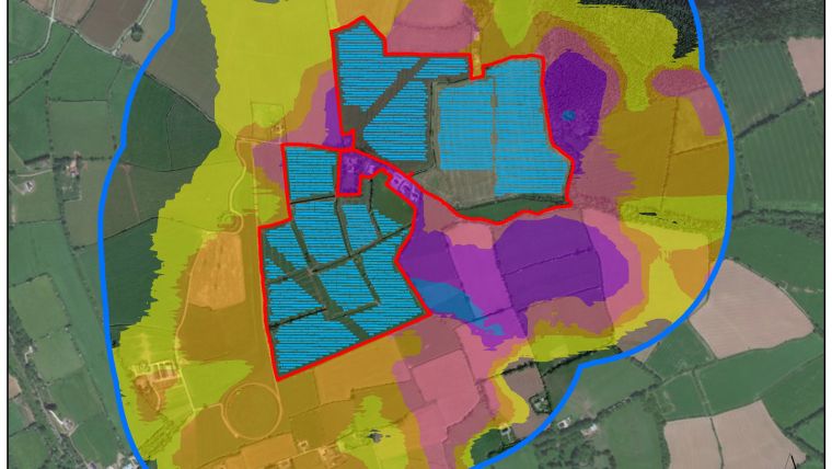
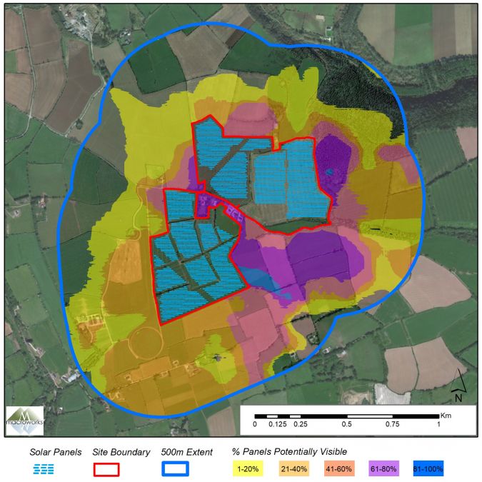
Working on behalf of solar energy developers across the republic, landscape consultancy firm Macro Works uses Bluesky’s models to produce several outputs, including Zone of Theoretical Visibility (ZTV) maps and Glint and Glare assessment reports. These, together with a Landscape Mitigation Plan, have already helped secure permission for over 100 solar farms, including Ireland’s largest permitted development to the north-west of Midleton, County Cork.
DSM Data for Screening by Existing Vegetation
“Traditional ZTV mapping is based on bare-ground terrain data. However, the Bluesky DSM data allows screening by existing vegetation and buildings to be accounted for and also allows us to incorporate proposed mitigation and examine its effectiveness,” commented Luis Dominguez, senior GIS analyst at Macro Works. “This form of analysis is extremely useful for placing a new structure into almost any setting but is particularly effective for solar developments where we use the process to inform both our Landscape and Visual Impact Assessments and Glint and Glare analysis.”
“Before Bluesky DSM data was available, we captured and processed our own models using a survey-grade drone,” he continued, “however, this was weather dependent, time consuming and expensive. Now that Bluesky has captured, and continues to maintain, high-quality DSM data for the whole of the Republic of Ireland, we can rely on them for the instant provision of accurate and up-to-date datasets.”
Geospatial Data for Key Insights
Ralph Coleman, sales director at Bluesky, added: “Geospatial data is proving to be integral to many initiatives tackling climate change. It provides key insight at the planning stages of projects, such as the installation of solar farms, meaning the correct sites can be identified quickly, saving time and money. Importantly, our customers can have immediate access to our DTM and DSM datasets meaning progress can be made at pace.”
Macro Works has worked with Bluesky for many years completing a large volume of Landscape and Visual Impact Assessments (LVIA) on solar farms, wind energy developments and other major infrastructure projects. The company specializes in LVIA for energy, infrastructure and commercial developments and is the only Landscape Architecture practice in Ireland solely dedicated to LVIA. Macro Works has a specialist GIS team which has developed a range of advanced forms of analysis as well as Ireland’s only proprietary Glint and Glare analysis software and was one of the first to utilize both DTM and DSM data within its LVIA works.

Value staying current with geomatics?
Stay on the map with our expertly curated newsletters.
We provide educational insights, industry updates, and inspiring stories to help you learn, grow, and reach your full potential in your field. Don't miss out - subscribe today and ensure you're always informed, educated, and inspired.
Choose your newsletter(s)


