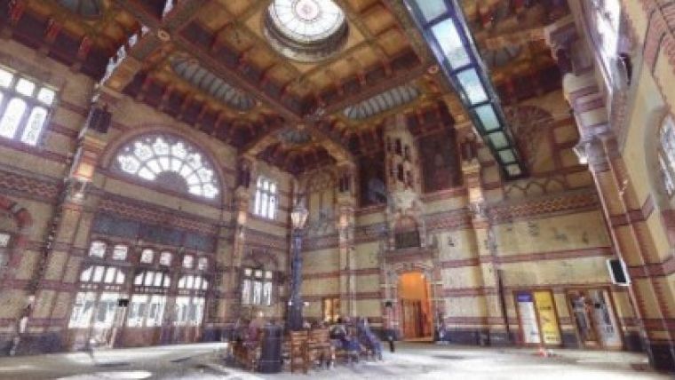
3D Railway Imaging Project in Groningen
By 2020, the area surrounding the railway station in the Dutch city of Groningen must be completely revitalised. Local company Geomaat has already captured 3D images of the entire area using a 3D laser scanner. Combined with high-resolution photographic images, the company has produced a coloured 3D point cloud allowing extremely precise measurements to be performed. This makes it particularly suitable as the basis for a Building Information Model (BIM).
Some 10 years ago, when static laser scanning was introduced, a point cloud with photos was unworkable for end users. Too much drawing work was required to convert it into a usable file. That is no longer the case in 2014. Nowadays, users can log in via a web portal and access all the data. Furthermore, it is possible to perform measurements within the data and make notes. Needless to say, it is also possible to use the scan data to produce a complete 3D CAD model.
For product information about laser scanning visit Geo-matching.
Image courtesy: Geomaat.

Value staying current with geomatics?
Stay on the map with our expertly curated newsletters.
We provide educational insights, industry updates, and inspiring stories to help you learn, grow, and reach your full potential in your field. Don't miss out - subscribe today and ensure you're always informed, educated, and inspired.
Choose your newsletter(s)


