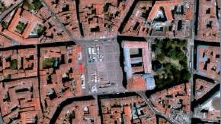
50cm Imagery Satellite Preparing for Launch
Astrium Geo is working to launch the Pléiades 1 satellite on 16th December 2011 on a Soyouz rocket leaving from Kourou spaceport in French Guiana. It is the first of two identical satellites that will image the Earth, delivering 50cm imagery products, for more than ten years. Such a high resolution paves the way for finer mapping, more detailed photo interpretation, enhanced services and a new range of high-resolution 3D products.
Pléiades has been designed with maximum reactivity in mind. It will be accessible through innovative tasking services, allowing access to new imagery faster than ever. This reactivity is ideal to serve efficiently the need for urgent information such as in the emergency, risk and crisis community.
Pléiades 1 will be joined in space by its twin, Pléiades 2, in a year. The two satellites will be operated on a phased orbit, enabling a daily revisit capacity anywhere on Earth, for any application requiring regular monitoring.
Pléiades 1 imagery (as simulated with this article) will be commercially available from March 2012.

Value staying current with geomatics?
Stay on the map with our expertly curated newsletters.
We provide educational insights, industry updates, and inspiring stories to help you learn, grow, and reach your full potential in your field. Don't miss out - subscribe today and ensure you're always informed, educated, and inspired.
Choose your newsletter(s)


