Adelaide Hills Fires Image Captured by Landsat 8
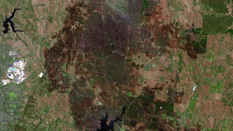
Fires continue to burn across parts of South Australia as the heatwave emanating from central Australia raises temperatures in the region. This satellite image of the Adelaide Hills fires, taken at 11:30 a.m. on 4 January 2015 by the United States Geological Survey Landsat 8 satellite, shows the active fire front to the top right of the picture (red with white smoke plumes).
Burnt areas appear as dark brown below the fire front. Light-brown areas are dry grass, while green indicates crops, forests and irrigated areas. Several large reservoirs appear as black. Geoscience Australia also uses satellites to map 'hotspots' which are delivered through the Sentinel application.
Image courtesy: Geoscience Australia using data from the United States Geological Survey Landsat 8 Satellite.

Value staying current with geomatics?
Stay on the map with our expertly curated newsletters.
We provide educational insights, industry updates, and inspiring stories to help you learn, grow, and reach your full potential in your field. Don't miss out - subscribe today and ensure you're always informed, educated, and inspired.
Choose your newsletter(s)


