Advanced Aerial Mapping Provides Valuable Information to First Responders
In the wake of Hurricane Henri and Hurricane Ida, Applanix, a Trimble Company, and NOAA recently collaborated to provide critical information to first responders. Applanix’s high-accuracy direct georeferencing (DG) technology enabled the National Oceanic and Atmospheric Administration (NOAA) to quickly collect aerial mapping imagery to provide valuable disaster remediation information to first responders, and demonstrate the value of cutting-edge mapping technology in preparing for and responding to emergency situations such as hurricanes, tornadoes and other disasters.
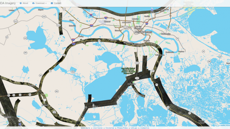
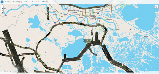
Within hours of Hurricanes Henri and Ida making landfall, NOAA’s National Geodetic Survey collected post-storm imagery using the latest generation Digital Sensor System (DSS). The sixth-generation DSS, designed and manufactured for Applanix by Lead’Air, is one the most powerful to date, thanks to several new features introduced within the solution.
Wide range of high-end aerial mapping features
One of the new features is the ability of simultaneous full-colour and near-infrared image capture using high-performance Phase One iXM 100 MP NIR and 150 MP RGB cameras. The system also offers the possibility to fly the cameras in wide-coverage oblique or traditional overhead (straight line down) mode for mapping with uninterrupted measurement, and has an embedded Trimble AP60 global navigation satellite system-inertial (GNSS-inertial) OEM DG solution for mapping without the need for ground control or aerial triangulation.
Part of the workflow is Applanix POSPac post-processing software featuring the Trimble post-processed CenterPoint RTX correction service (PP-RTX) for centimetre-level mapping without GNSS reference stations. Another eye-catching feature is the in-air development of raw imagery to JPEG-ready files for creating map products immediately upon landing, while also worth mentioning is Lead’Air’s innovative X-Track flight management, which enables the system to be flown outside of planned flight lines to follow roads, rivers and coastlines.
Applanix’s DG technology suite provides direct GNSS inertial georeferencing, meaning that all pixels in the aerial images taken by NOAA are mapped at their exact location on the ground.
Turnkey emergency response imagery
“We have worked with Applanix for nearly 20 years,” said Michael L. Aslaksen Jr, chief of the remote sensing division of NOAA's National Geodetic Survey. “The level of sophistication they bring to aerial imagery and mapping keeps our team at the forefront of the industry. Their customer support team is always open to new ideas, new innovations and doing whatever it takes to get the job done.”
First responders have access to this imagery and mapping within 24 hours via the cloud (zoom in for the detailed images) and can map detailed response plans based on highly accurate data highlighting where the greatest need lies. Access to this turnkey emergency response imagery is available to any federal agency, municipality, insurance companies and other entities who depend on highly accurate information to plan for and recover from disasters.

Value staying current with geomatics?
Stay on the map with our expertly curated newsletters.
We provide educational insights, industry updates, and inspiring stories to help you learn, grow, and reach your full potential in your field. Don't miss out - subscribe today and ensure you're always informed, educated, and inspired.
Choose your newsletter(s)


