Aerial Imagery Assists Emergency Response
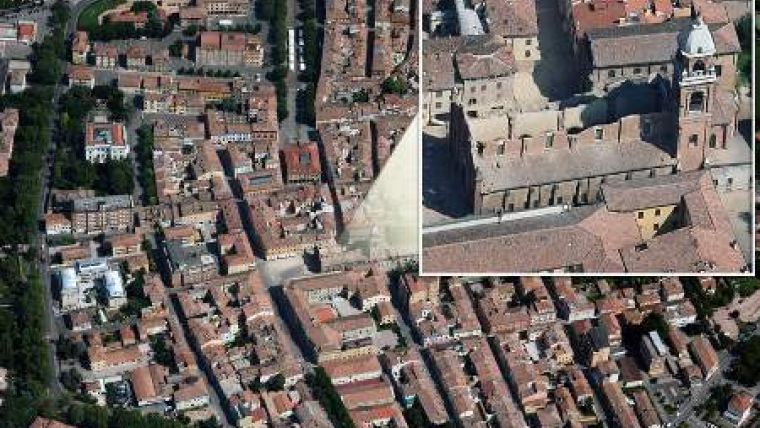
In May 2012 the Emilia Romagna region, in the middle of Pianura Padana in Northern Italy, was hit by a seismic swarm which led to a number of earthquakes measuring upwards of 5 on the Richter scale. Following the two earthquakes on 19 and 28 May respectively, Blom conducted flights which resulted in the capture of 70 sq km of orthoimagery at 7cm GSD and 450 sq km of oblique imagery at 10/15cm GSD. The data was made available to the Italian Civil Defence and Regional Government and is being used as a resource for damage estimation, rescue-planning activities and clear-up operations.
The imagery was rapidly uploaded to Blom’s geoserver BlomURBEX in order to further facilitate immediate access to the data required by the local entities affected by the earthquake.
Blom, headquartered in Denmark, has a longstanding history of assisting Government Agencies and Local Authorities in the event of natural disasters such as earthquakes, flooding, landslides and wildfires. Affected areas are flown over to capture the full scale of disasters and the data allows analysis of the worst-hit areas for a comprehensive understanding of the territories.

Value staying current with geomatics?
Stay on the map with our expertly curated newsletters.
We provide educational insights, industry updates, and inspiring stories to help you learn, grow, and reach your full potential in your field. Don't miss out - subscribe today and ensure you're always informed, educated, and inspired.
Choose your newsletter(s)


