Aerial Mapping Canada’s First Highway to the Arctic
Researchers at the Alaska Center for Unmanned Aircraft Systems Integration (ACUASI) recently completed a high-resolution map of Canada’s first all-weather road to the Arctic: the Inuvik-Tuktoyaktuk Highway. The team undertook the project in 2019, capturing over 60,000 overlapping aerial photographs of the new road and a large stretch of the adjoining Dempster Highway. The effort, which used a remotely piloted SeaHunter aircraft, is one of the largest non-military remote sensing projects of its kind.
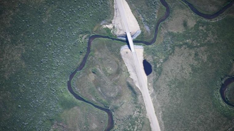
The new two-lane, all-weather gravel highway snakes its way north for 140 kilometres, crossing numerous streams that support fish populations integral to indigenous communities in the region. Fisheries and Oceans Canada wanted to find a way to safely and effectively monitor potential changes to freshwater habitats.
ACUASI is one of several Geophysical Institute facilities at the University of Alaska Fairbanks and is the largest UAS operator in the Arctic. ACAUSI had previously collaborated with Transport Canada to help with endangered whale monitoring in Canada’s busiest shipping lanes in the Gulf of St. Lawrence.
Photogrammetry mosaic
To map the highway, the team first had to install an array of equipment onto the 300-pound SeaHunter aircraft and design a flight plan that would allow them to map the entirety of the Inuvik-Tuktoyaktuk Highway and a portion of the Dempster Highway. The SeaHunter traversed thousands of miles, photographing every square inch of the roads in overlapping increments.
Eyal Saiet, an ACUASI remote sensing specialist, stitched the photos together using photogrammetry to create a detailed mosaic. “The camera took photographs about once every second for nearly the entirety of the flight, which could sometimes last up to eight hours,” said Saiet.
The team communicated with the aircraft and equipment onboard via a network of polar orbiting satellites, allowing them to estimate how many photographs had been taken and how much memory storage was still available.
Lidar-based elevation models
In northern Canada, detailed mapping projects are sporadically carried out by manned aircraft and mapped with Lidar, or by short-range drones at specific sites of interest. But unmanned aircraft, such as SeaHunter, are seen as a safer and more fuel-efficient means of generating high-resolution imagery and elevation models over large areas.
Both Wentworth and Saiet were recently honoured by Fisheries and Oceans Canada for their meticulous and exacting work of mapping the highways.
The ACUASI team is now looking forward to further collaboration with US and Canadian agencies. Their contract with Transport Canada to monitor North Atlantic right whales has been renewed, so the crew and the SeaHunter expect to head back to the Atlantic this summer to resume their efforts at preventing whale-cargo vessel collisions.

Value staying current with geomatics?
Stay on the map with our expertly curated newsletters.
We provide educational insights, industry updates, and inspiring stories to help you learn, grow, and reach your full potential in your field. Don't miss out - subscribe today and ensure you're always informed, educated, and inspired.
Choose your newsletter(s)


