Aerial Mapping Helps Prevent Trees Falling onto Power, Road and Rail Networks
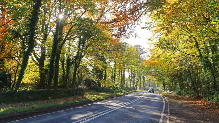
Aerial mapping from Bluesky is helping to reduce the risk of trees falling onto power lines, key roads and railways. As part of a project funded by the Natural Environment Research Council (NERC), 3D data produced by Bluesky is being used by scientists at the University of Lancaster, UK, to refine a tree failure risk model that currently uses complex wind analysis techniques to assign a level of risk to individual trees.
The data - Bluesky’s UK National Tree Map, laser mapped 3D height models, Colour Infrared (CIR) data and soil data – will help identify individual trees and their proximity to electricity, road and rail infrastructure, as well as help to make more detailed assessment of their location, health and other features that may cause failure. This is the first tree failure prediction model to approach the problem using individual tree parameters, rather than whole tree stands.
Geospatial data
The aim of the project is to develop a scientifically based, robust and objective method to predict tree failure in severe weather conditions, commented Dr Alan Blackburn, senior lecturer at the Lancaster Environment Centre, part of the University of Lancaster. Using the Bluesky data, they will refine the existing model with better identification and location of individual trees and groups of trees. The data will also help to identify trees that may be in poor health or have other features that may contribute to failure, and therefore better inform pre-emptive measures, Blackburn added.
The Lancaster Environment Centre is also working with Bluesky to create a web based GIS application embedding the prediction model, to deliver the results to users across a range of sectors and applications in an intuitive and interactive map format.
Lidar height models
James Eddy, technical director of Bluesky, said the project team has already completed the first phase of work and has a functioning model that can run historic wind events or future wind predictions and assign a risk to each tree. By improving the initial representation of tree characteristics and context with Bluesky’s National Tree Map data, Lidar height models and NDVI classification, it is hoped it will be possible to simulate individual tree failures and their impact on infrastructure networks.
The project, titled ‘Delivering Resilient Power, Road and Rail Networks by Translating a Tree Failure Risk Model for Multi-Sector Applications’, is being led by Lancaster University with funding from NERC and Scottish Power. Other stakeholders include UK Power Networks, Scottish Power, Transport Scotland, Scottish Water, Atkins Global, ADAS and the British Geological Survey (BGS).

Value staying current with geomatics?
Stay on the map with our expertly curated newsletters.
We provide educational insights, industry updates, and inspiring stories to help you learn, grow, and reach your full potential in your field. Don't miss out - subscribe today and ensure you're always informed, educated, and inspired.
Choose your newsletter(s)


