Aerial Mapping Tool Helps Local Governments Plan for Disasters
A new geospatial tool has been designed help local governments plan for severe weather events, support recovery and expedite insurance claims.
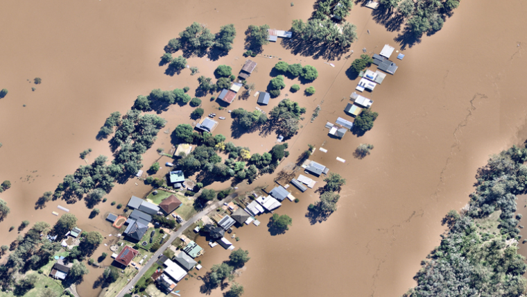
Australian-based aerial imagery and location analytics provider Nearmap is aiming to map every major natural disaster in the country that significantly impacts property, infrastructure and communities, including bushfires, cyclones, storms, hail, earthquakes, flooding and tsunamis.
It has already captured more than 6,200 square kilometres of disaster-affected land including the New South Wales floods, the Perth Hills fires and Cyclone Seroja in Western Australia.
Nearmap managing director and CEO Rob Newman says the company is committed to covering an additional 15,000 square kilometres of disaster-affected land outside its regular capture programme. According to Nearmap, the information can help organizations assess damage, plan disaster responses and manage rebuilding and recovery, with its ImpactResponse tool providing city-scale aerial imagery and location data within days of a disaster.
The tool was developed in collaboration with government agencies and disaster relief organizations including Disaster Relief Australia.

Value staying current with geomatics?
Stay on the map with our expertly curated newsletters.
We provide educational insights, industry updates, and inspiring stories to help you learn, grow, and reach your full potential in your field. Don't miss out - subscribe today and ensure you're always informed, educated, and inspired.
Choose your newsletter(s)


