Aerial Photography Keeps Birmingham Moving
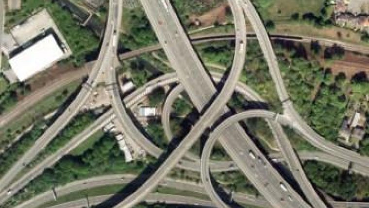
High-resolution aerial photography from Bluesky is helping Birmingham City Council (UK) to undertake a host of transport-related applications, thus ensuring users of roads, footpaths and canals stay on the move. The digital map layer is made available to specialist users through the Council’s Geographical Information System (GIS) and to every desktop in the organisation with a simple ‘view only’ browser.
Purchased to update existing aerial photography, the 10cm resolution dataset allows users to undertake multiple tasks in the office, thus reducing the time spent by council staff in the field.
The Birmingham City Council needed to update its aerial photography as the previous dataset, also from Bluesky, was already five years old, commented Michael McGuinness, property information manager at the City Council. Bluesky was selected following a tender and evaluation exercise.
The Bluesky photography purchased by Birmingham City Council was delivered ahead of schedule as a 10cm-resolution digital dataset. Flown in the summer of 2012, covering the whole of the metropolitan area – 267 square kilometres – the data is being used across the organisation, which is the largest local authority in Europe.
Used across most departments, including Planning, Housing, Property and Emergency Planning for example, Bluesky aerial photography and the ability to overlay business data on the photography increases the number of tasks that can be completed in the office, thus reducing the time spent by officers on site which in turn allows for cost savings and efficiency gains.
An example is the use of aerial photography within the highways arena, including identification and mapping of highway assets, planning and delivery of traffic surveys and design and layout of new junctions.
Further specific applications of the Bluesky aerial photography include identification and mapping of bus and cycle lanes, verification of vegetation along the highway, checking for possible mistakes in road markings and identification of off-street car parks.
The aerial images supplied by Bluesky form part of its off-the-shelf archive of high-resolution, georeferenced aerial imagery and derived datasets. With nationwide coverage, this is one of the most up-to-date, comprehensive and widely used orthorectified image databases available in the UK today. New aerial photographs and datasets are continually added through a five-year rolling programme.

Value staying current with geomatics?
Stay on the map with our expertly curated newsletters.
We provide educational insights, industry updates, and inspiring stories to help you learn, grow, and reach your full potential in your field. Don't miss out - subscribe today and ensure you're always informed, educated, and inspired.
Choose your newsletter(s)


