AEROmetrex Reaches Millionth UltraCam Frame Milestone
AEROmetrex, the Australian digital mapping specialist, has achieved the impressive milestone of collecting 1,000,000 frames of UltraCam digital aerial imagery. As an early adopter of digital mapping technology, AEROmetrex has owned and operated UltraCam digital systems for eight years.
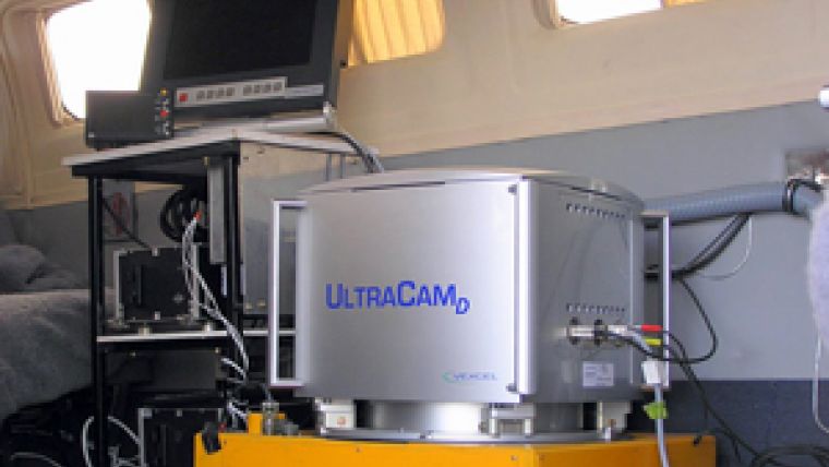
The decision to be first in the market with a large-format digital mapping camera was not an easy one in 2005. It was a visionary move by our director at the time, said Mark Deuter, managing director of AEROmetrex. The company is still flying the UltraCamD and UltraCamX cameras purchased in 2007, and they are performing admirably. AEROmetrex is growing and it expects to make further UltraCam purchases in the medium-term future.
With the UltraCam cameras, AEROmetrex can fly all resolutions from 2.5cm GSD to 90cm GSD with one camera system. The company can achieve vertical accuracies of 30mm at 95% confidence interval at 2.5cm GSD, then the next day capture thousands of square kilometres of regional imagery. It has used the UltraCams in very difficult working environments, sometimes thousands of kilometres from its home base, in temperatures up to 50°C and down to freezing.
AEROmetrex is optimistic about the future growth of the company and the opportunities offered by geospatial technology. Mark Deuter thinks the company has barely begun to explore the full range of applications for accurate, high-resolution imagery and for 3D mapping from aerial imagery. It is an incredibly exciting time to be a photogrammetrist, he added. There has been a wave of new photogrammetric processing technologies since 2009 as well as the mass availability of 3D stereo viewing hardware (TVs, tablets and computer monitors) at affordable prices. Now AEROmetrex really has the ability to display its products in 3D, and it is great to see the rapid uptake and assimilation of this technology by the clients, Deuter explained.
Whether dealing with vast regional surveys or cityscape captures, or extremely-high resolution engineering surveys, the ability of imagery to capture the geometry, location, texture, colour and form of any object is unparalleled. AEROmetrex looks forward to continuing its work using UltraCam cameras and collecting another 1,000,000 frames, Deuter continued.

Value staying current with geomatics?
Stay on the map with our expertly curated newsletters.
We provide educational insights, industry updates, and inspiring stories to help you learn, grow, and reach your full potential in your field. Don't miss out - subscribe today and ensure you're always informed, educated, and inspired.
Choose your newsletter(s)


