AeroMetric Launches High-accuracy Mapping Solution
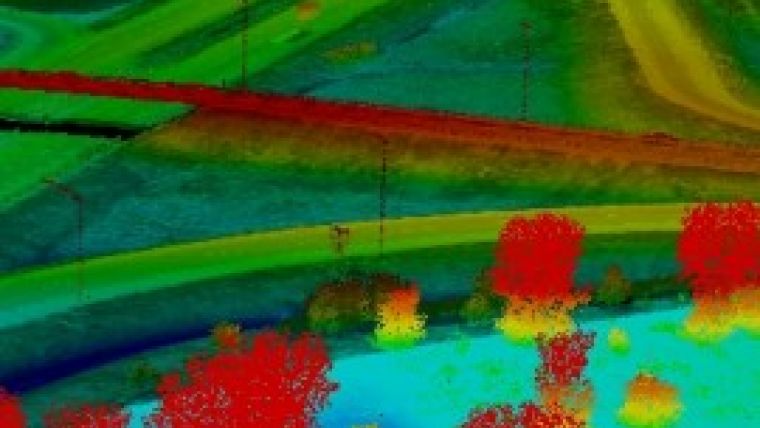
AeroMetric has announced the addition of a new high-accuracy mapping solution for its clients. The new solution is designed to obtain tight vertical accuracy and highly detailed imagery using a helicopter-based sensor system mounted on a drift-control platform. The sensor system includes a RIEGL VQ-480i Lidar sensor and a Phase One iXA 80 MP digital camera, and is controlled through Track’Air’s Flight Management System.
AeroMetric’s new system is developed to extend and improve AeroMetric’s mapping solutions, which are based on digital image and Lidar acquisition at very low altitudes – usually 500-1,000 feet AGL. AeroMetric’s High Accuracy Mapping Solutions are particularly well suited for engineering design and similarly detailed applications in transportation corridors, transmission lines and pipeline routes.
Terry Keating, AeroMetric chief technology officer, said the new sensor system’s drift control allows it to remain aligned with the corridor regardless of the direction the aircraft is flying to adjust for wind conditions. This is an important feature that will provide clients the accuracy and detail they will require for engineering level mapping, he added.

Value staying current with geomatics?
Stay on the map with our expertly curated newsletters.
We provide educational insights, industry updates, and inspiring stories to help you learn, grow, and reach your full potential in your field. Don't miss out - subscribe today and ensure you're always informed, educated, and inspired.
Choose your newsletter(s)


