Applanix Unveils OEM Solution for Direct Georeferencing of Airborne Sensor Data
This article was originally published in Geomatics World.
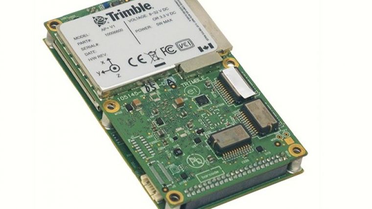
Applanix, a Trimble company, has introduced the Trimble AP+ Air OEM solution for direct georeferencing of airborne sensor data. The solution enables users to accurately and efficiently produce maps and 3D models without the use of ground control points.
The Trimble AP+ Air is developed as a powerful solution for manned platforms, yet small enough for use on UAVs. It is also compatible with virtually any type of airborne remote sensor, including photogrammetric cameras, Lidar, hyper and multi-spectral cameras, and synthetic aperture radar.
Direct georeferencing accuracy demands
Comprised of next-generation compact, low-power hardware, the Trimble AP+ Air features dual embedded survey-grade GNSS chipsets, an onboard inertial measurement unit (IMU), an external IMU, and the all-new Applanix IN-Fusion+ GNSS-aided inertial firmware. It is configurable to support the direct georeferencing accuracy demands of low flying UAVs to high-altitude manned platforms.
“We have taken the most advanced features of Applanix Direct Georeferencing and Trimble GNSS technology and packaged them into a powerful new, compact and versatile solution,” said Joe Hutton, Applanix’ director of inertial technology and airborne products. “It provides the flexibility required by systems integrators to embed a single hardware solution that can then be configured to meet the different Direct Georeferencing needs of a specific sensor type, whether flown on a UAV or manned aircraft. It truly is an ‘integrate once, use many times’ solution.”
Efficient airborne mapping
The Trimble AP+ Air is fully supported by the industry-leading Applanix POSPac MMS post-processing software, which features CenterPoint RTX post-processing for centimetre-level positioning anywhere in the world without the need for base stations. These capabilities make the solution very suitable for integrators to produce a highly efficient airborne mapping system.
For Lidar integrators, the Trimble AP+ Air is compatible with the POSPac MMS Lidar QC Tools for computing boresight as well as adjusting the relative accuracy of the POSPac trajectory being used to generate the point cloud. For integration with cameras, the solution is supported by the POSPac MMS Photogrammetry Tools for computing boresight and performing camera IO quality control.

Value staying current with geomatics?
Stay on the map with our expertly curated newsletters.
We provide educational insights, industry updates, and inspiring stories to help you learn, grow, and reach your full potential in your field. Don't miss out - subscribe today and ensure you're always informed, educated, and inspired.
Choose your newsletter(s)


