Automated Deformation Monitoring Projects for Waterways
Round-the-clock Observation of a Damaged Weir in the Netherlands Restores Safety with Confidence
Automated movement detection supports informed decisions about infrastructure, including for waterways as illustrated by this project in the Netherlands. Following storm-related damage to a weir on the River Maas, Trimble dealer Geometius quickly helped to set up a real-time automated system. It monitored the weir 24/7 to give stakeholders advance warning of potential catastrophe in the case of excessive movement.
It is not uncommon for powerful and long-lived windstorms to strike Europe. A recent example is Storm Ciara, an extratropical cyclone that caused significant wind and flooding damage across the continent, leading to the emergency repair of a damaged weir in the Netherlands.
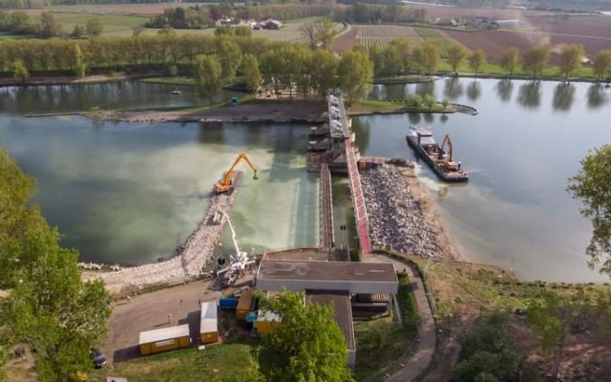
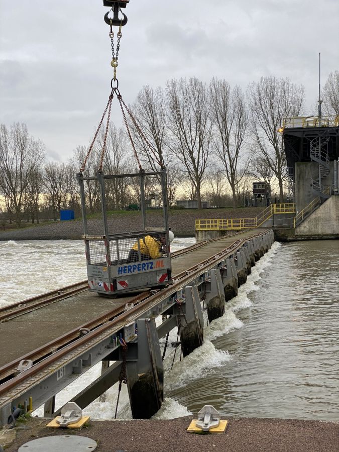
During the storm, two push barges drifted away from their moorings along the River Maas and collided with a weir (i.e., a low head dam) near the Dutch town of Linne. The Maas is one of several important waterways crucial to the trade-based economy of the Netherlands, as well as providing fresh water used for irrigation and drinking water. To protect the nearby Linne community and keep the regional river-related economy operating, an immediate plan of action was put into place by engineering services experts from Geonius to monitor the damaged weir and the subsequent repair work.
Manual monitoring of the damage
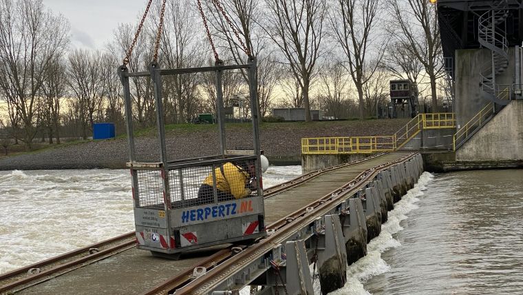
Mourik Infra – a technical service provider responsible for weir maintenance on behalf of Rijkswaterstaat, the executive agency of the Netherlands’ Ministry of Infrastructure and Water Management – reached out to Geonius immediately. Within an hour of the damage, Geonius project manager Hassan El Gardaoui and his team began manual monitoring of the weir. The team’s first goal was to determine the damaged weir’s stability and provide advance warning of an imminent collapse. This process required measurements of the weir to be taken every 10 minutes to determine whether significant movement had occurred.
In collaboration with Geometius, a Trimble dealer specializing in surveying, geographical and hydrographic applications, the Geonius manual monitoring solution was set up and Mourik Infra built two temporary dams that would make it possible to perform a complete inspection of the damage and support repair work. The temporary dams controlled the river’s water flow and provided access to the damaged weir. At this point, Geonius was manually monitoring the weir and the temporary dams for stability and movement. For two weeks, two surveyors were on site 24/7 making manual calculations. “This was not a sustainable solution and we knew there must be a way to reduce the intensity of the work without sacrificing safety or project integrity,” says El Gardaoui.
Although it is relatively simple to set up a manual monitoring system, which typically consists of a data collector like the Trimble TSC3 controller and a Trimble S9 robotic total station, the work itself is repetitive and can be costly. A surveyor is sent out to the site at regular intervals to take measurements, then downloads the measurements into a spreadsheet and manually performs calculations to look for any movement changes to the monitored points.
Leveraging automation
Transitioning from a manual to an automated system requires a continuous on-site power source that can provide uninterrupted communication with the sensors to provide real-time data. As this change took place, manual monitoring continued until the automated system was fully operational. Real-time monitoring on the weir was complete within two days.
The automated system used a Trimble TSC3 controller to initialize the setup and a Trimble S9 total station connected to a Settop M1 data collector to automatically collect and stream data to the required stakeholders. The total station was set up to take measurements of defined points marked by prisms at regular intervals. These intervals can be as frequent as every few minutes or stretch out to be taken daily.
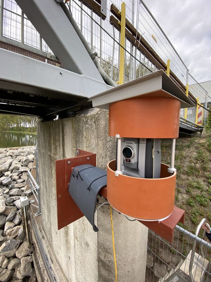
Once the monitoring hardware was configured, it automatically fed the total station measurements into Trimble 4D (T4D) Control, Trimble’s software platform for automated movement detection. Configured and installed by Geonius with Geometius’ support, several benefits were realized, including:
- Enhanced data collection and visualization – by moving from Excel spreadsheets to a customizable, digital dashboard, Geonius could share reports with Mourik Infra and other project stakeholders in real time. Compared to a manual process, the automated system collected more data – and much more efficiently – for engineering teams to review and act upon.
- Automated alarms – T4D triggered alarms when deformation exceeded acceptable movement thresholds, providing advance warning of potential damage or catastrophe. As soon as an alarm was triggered, all key project stakeholders would receive email and text alerts.
- Improved project management – while the transition from manual to automated monitoring required substantial work, Geonius experiences the benefits of automated monitoring every day. “The trendlines from T4D Control help us to determine if there really was a deformation or if it was simply a result of temperature, air pressure or rising water causing the deviations,” says El Gardaoui. “If you collect enough of the right data, you have the opportunity to make better probability calculations and see patterns.”
- Project safety – deformation monitoring provides an extra layer of safety to the project teams and those living and working near the area. Thanks to a software platform like T4D, stakeholders have the data transparency needed to plan for and mitigate risks.
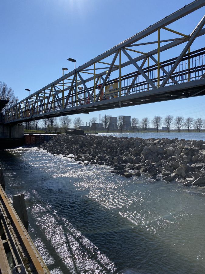
The new weir is now complete and Geonius continues to monitor the structure, while also applying automated deformation monitoring to several other projects in the Netherlands.

Value staying current with geomatics?
Stay on the map with our expertly curated newsletters.
We provide educational insights, industry updates, and inspiring stories to help you learn, grow, and reach your full potential in your field. Don't miss out - subscribe today and ensure you're always informed, educated, and inspired.
Choose your newsletter(s)


