Blaze Terra Extension to Enable Customers to Access WAMI
Eternix, specialised in next-generation software for GIS visualisation and editing in 3D, has released its first WAMI extension, enabling Blaze Terra users to access WAMI data through cloud-based services. WAMI stands for Wide Area Motion Imagery and is an advanced sensor-based technology, delivering board stretches of video-like footage. WAMI has been gaining popularity since its adoption by the Open Geospatial Consortium (OCG).
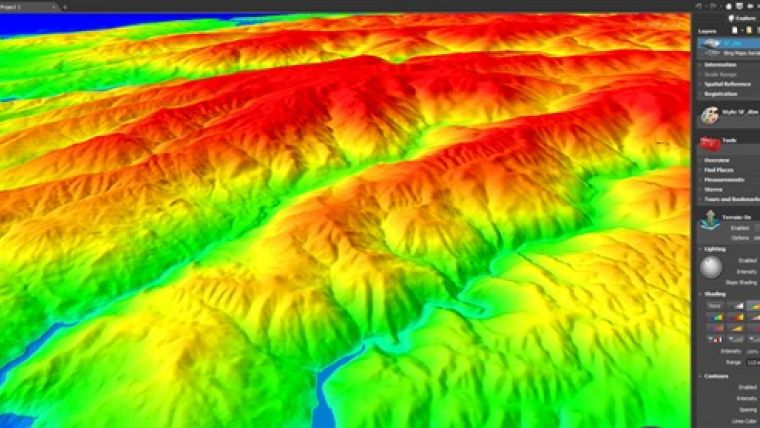
Blaze Terra’s advanced GIS environment allows real-time decision-makers working with WAMI to yield optimal insights and results. Instant overlay of WAMI data with Digital Elevation Models (DEM) or any other geospatial data, such as 3D models, raster or shape files, ensures the comprehensive user experience Blaze Terra is known for. In addition, a set of WAMI specific features, such as playback control and feature tracking, utilise WAMI’s inherent video qualities.
Eternix believes that Blaze Terra’s high-end capabilities open a whole set of new chances for GIS professionals working with WAMI, said Daniel Zeitlin, CTO at the company. Vital application of WAMI occurs in areas where real-time decision-making is key. Blaze Terra’s fast processing speed and holistic approach make it an excellent choice for such real-time applications, he added.

Value staying current with geomatics?
Stay on the map with our expertly curated newsletters.
We provide educational insights, industry updates, and inspiring stories to help you learn, grow, and reach your full potential in your field. Don't miss out - subscribe today and ensure you're always informed, educated, and inspired.
Choose your newsletter(s)


