Bluesky 3D Maps Enhance Ambiental’s Future Climate Change Flood Risk Model
This article was originally published in Geomatics World.
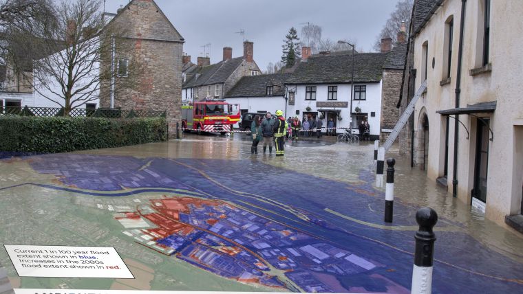
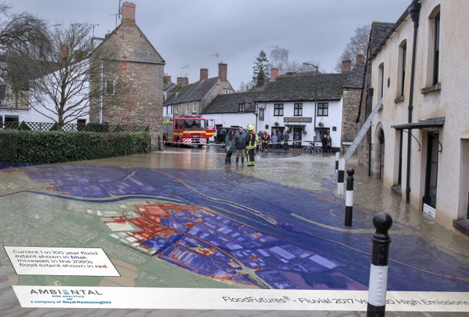
3D terrain data from aerial mapping company Bluesky is being used to upgrade the first national climate change flood model for Great Britain. Created by Ambiental Risk Analytics as part of its climate change adaptation product range, the FloodFutures map brings together the latest river flow, rainfall, storm surge and climate change predictions and addresses all major sources of flooding.
Providing insight into future flood hazards in order to reduce damage and risk to lives and property, FloodFutures utilises Bluesky’s photogrammetrically derived 3D terrain data (Digital Terrain Model / DTM) which covers the whole of England, Scotland and Wales.
“The impact of global warming and rising sea levels is intensifying, and the UK is witnessing higher temperatures and changing rainfall patterns resulting in more intense storms, more extreme flash flooding and more frequent droughts,” commented Rob Carling, Channel Sales Manager, Ambiental Risk Analytics. “As the risk of flooding increases and the impact of flood events becomes more severe, we are intensifying our research and development and the partnership with Bluesky will underpin the creation and promotion of our evolving Climate Suite products.”
Accurate terrain mapping
FloodFutures, part of Ambiental’s Climate Suite, addresses all major sources of flooding for current and future emissions scenarios – including rivers, tidal, and surface water (which is also known as pluvial flooding). Ten flood scenarios are presented, allowing a quick assessment of risk in relation to physical infrastructure, environmental features and population. Information is provided for the present day, and three different climate scenarios (low, medium and high emissions) in three future epochs (2020s, 2050s and 2080s). This release of the FloodFutures range is based on UKCP climate predictions.
“We are delighted to continue our relationship with Ambiental, having worked together on previous flood map products,” added Rachel Tidmarsh, managing director of Bluesky International. “By incorporating up-to-date and accurate terrain mapping with Ambiental’s sophisticated modelling software and techniques ensures we are supplying the best intelligence for flood risk assessments.”
Ambiental’s FloodFutures data together with Ireland Flood Map data will soon be available for engineering consultants, property developers and asset managers; for example, to view, purchase and download from Bluesky’s online Mapshop.

Value staying current with geomatics?
Stay on the map with our expertly curated newsletters.
We provide educational insights, industry updates, and inspiring stories to help you learn, grow, and reach your full potential in your field. Don't miss out - subscribe today and ensure you're always informed, educated, and inspired.
Choose your newsletter(s)


