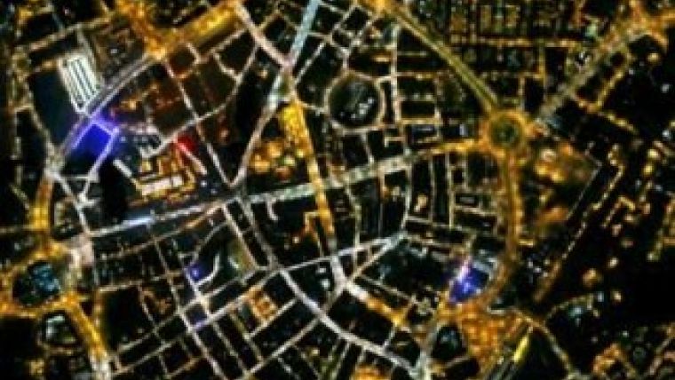
Bluesky Begins Night-time Aerial Photo Mapping Trials
Aerial survey specialist Bluesky is to conduct trials of the world’s first integrated night-time mapping system combining a specially adapted camera with Bluesky’s Lidar and thermal imaging sensors. It is hoped the trials will produce essential data to help combat light pollution and energy wastage and to help manage urban habitats. The resulting map-accurate images will be a useful tool for managing street lighting operations and maintenance and as a resource for tackling energy inefficiency.
Light pollution impacts all of us in many ways, commented James Eddy Bluesky’s technical director and industrial associate at the University of Leicester, from a loss of view of the night sky to health problems caused by lack of sleep. Intrusion of light into a bird or animals habitat can affect breeding or feeding patterns causing a threat to our urban wildlife, while inefficient or ineffective street lighting can impact crime patterns and costs money through wasted electricity.
By integrating a camera, specially adapted to cope with the challenges of night time surveying, within the aerial mapping system they can ensure high levels of positional accuracy for the night time images. Co-capturing detailed 3D measurements and thermal images will provide additional intelligence relating night time light levels to heat loss and height, James Eddy continued.
The Night Mapper system from Bluesky includes a camera specially adapted to cope with the low light levels and temperatures associated with night time aerial surveys. The integrated system also includes Bluesky’s Lidar system which uses aircraft mounted lasers to accurately determine the distance between the sensor and the ground or other targets such as buildings and vegetation as well as a thermal infra-red imaging system.
The map accurate night time images produced by the new system will be suitable for use in a desktop mapping tool or geographical information system (GIS). Using advanced spatial queries and mapping techniques the Bluesky Night Mapper data can be used by Local Authorities and conservation organisations to provide an assessment of light pollution. This will provide intelligence to help to reduce unnecessary illumination and focus lighting infrastructure where it is needed most. In particular it can be used as an aid for Local Authorities in planning their environmental zones for exterior lighting control within their Development plans and conservation bodies can validate whether species protected under the Wildlife and Countryside Act are being impacted by light pollution.
The night time images can also be used as an aid for street lighting inventories and condition assessments; with 7.4million road lights in the UK, identifying those requiring replacement could lead to substantial savings. Additional applications of the night-time survey images are also expected to include measurement of illumination for energy consumption evaluations and additional intelligence to support innovative projects to ‘dim’ or even switch off selected streetlights in an effort to save money and reduce carbon emissions.
The integrated night mapping system has been developed in partnership with the University of Leicester following a Bluesky funded research project.

Value staying current with geomatics?
Stay on the map with our expertly curated newsletters.
We provide educational insights, industry updates, and inspiring stories to help you learn, grow, and reach your full potential in your field. Don't miss out - subscribe today and ensure you're always informed, educated, and inspired.
Choose your newsletter(s)


