Bluesky Creates National Tree Map for Ireland
This article was originally published in Geomatics World.
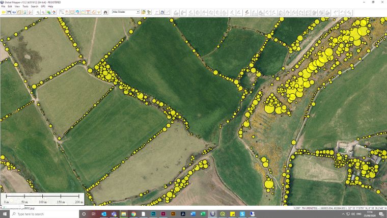
Aerial mapping company Bluesky International has started production of a new map of the Republic of Ireland, detailing an estimated 200 million trees. The National Tree Map (NTM) for Ireland will accurately record the location, height and canopy cover for trees over 3 metres in height. Combining 3D height models and other remotely sensed data, Bluesky has already created more than 2,500 square kilometres of data, detailing around 7 million trees.
“When we set about the task of mapping trees in a region, we are often surprised by just how green an area actually is,” commented Robert Loughran, international sales manager for Bluesky International. “For example, in England it was generally accepted that tree cover was around 10% but our National Tree Map revealed that it was in fact closer to 14%. Early production outputs indicate a similar pattern for Ireland which had previously been reported as having the lowest tree cover in the whole of Europe at around 11% whilst in fact we are seeing levels slightly in excess of this.”
Crown feature identification
Bluesky’s National Tree Map for Ireland is being created using innovative algorithms and image processing techniques in combination with the most up-to-date and detailed aerial photography. A team of experienced professionals then completed an exhaustive QA process to ensure the quality and accuracy of the data.
In addition to the three vector map layers; Crown Polygons, Idealized Crowns and Height Points, the Bluesky National Tree Map for Ireland will also include an attribute table including unique identification for each crown feature, height attributes and area calculations. The data will be available in a range of GIS ready formats with flexible annual licensing and will also feature on the Bluesky’s Irish Mapshop alongside the most up-to-date aerial photography, accurate height data and 3D building models.
Bluesky originally launched its National Tree Map product completing coverage and starting a programme of updates for the whole of England and Wales in 2013. Since then, government organisations, academic institutions and businesses have adopted the data with applications ranging from research into hay fever to council tree management to insurance risk assessment, to understanding how trees can damage underground pipes and sewers.

Value staying current with geomatics?
Stay on the map with our expertly curated newsletters.
We provide educational insights, industry updates, and inspiring stories to help you learn, grow, and reach your full potential in your field. Don't miss out - subscribe today and ensure you're always informed, educated, and inspired.
Choose your newsletter(s)


