Bluesky Launches Unmanned Aerial Vehicle
UK-headquartered aerial survey company Bluesky has launched a fast response aerial survey service using unmanned aerial vehicles (UAV) or drones. The technology, originally developed by the military, includes Artificial Intelligence (AI) guided autopilot, a high resolution integrated camera and environmentally friendly rechargeable propulsion system. Autonomous take-off and landing ensures the system is easy to use and, with a wingspan of less than a metre, it can be easily transported without the need for complex assembly.
The integrated camera captures high resolution photogrammetric images that can be used to create map-accurate aerial survey data including height models. The system is compact and lightweight making it easy to store and transport and can be launched by hand from virtually any location. Flight planning software and an artificial intelligence guided autopilot make it easy to control and the system will gently and safely return to the ground.
Potential applications of Bluesky’s UAV solution include open-cast mines or quarries or even landfill sites where large volumes of material are extracted or moved on a regular basis. The geographically accurate imagery would provide a record of activity at a given point in time and the highly detailed height models could be used to measure stockpiles, cut and fill volumes and for facilities management and safety monitoring.
Large scale construction sites can also be surveyed, at regular intervals or predetermined points in time, providing data for project management, reporting and funding. The height data can be used for line of site calculations to ensure compliance with planning applications or cut and fill calculations for project invoicing and for the creation of realistic 3D images for marketing or KPI reporting.
With an option of additional sensors mounted on the UAV, Bluesky is also exploring agricultural applications monitoring crop growth or irrigation and identifying locations for higher value crops or high yield areas. The system can also be used to identify fields with potential for solar panels and model the number, position and potential generation.
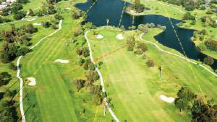
Additional applications are expected from within the leisure industry – specifically golf courses where the map accurate images and height models could be used to create yardage books, feed digital caddy systems and used to develop stroke manager solutions. The geographic data could also be used to support fairways design, construction and management.

Value staying current with geomatics?
Stay on the map with our expertly curated newsletters.
We provide educational insights, industry updates, and inspiring stories to help you learn, grow, and reach your full potential in your field. Don't miss out - subscribe today and ensure you're always informed, educated, and inspired.
Choose your newsletter(s)


