Bluesky Upgrades its Great Britain Flying Programme to Highest Ever Resolution
This article was originally published in Geomatics World.
Aerial mapping specialist Bluesky International has announced new plans to photomap the whole of Great Britain at 12.5 centimetre resolution – its highest level of detail for nationwide coverage to date. The company has already captured the whole of England at this resolution and will now also be upgrading its Wales and Scotland coverage to the higher resolution as part of its ongoing 3-year national update programme.
Bluesky holds a reputation to successfully capture and maintain complete aerial photographic coverage of England, Scotland and Wales as well as the Republic of Ireland.
“Advances in capture technology and processing systems mean that it is now viable to make this improvement in resolution across the whole of Great Britain and not just in selected areas. This allows us to deliver even better national products and services to the geospatial community,” commented Rachel Tidmarsh, managing director of Bluesky International.
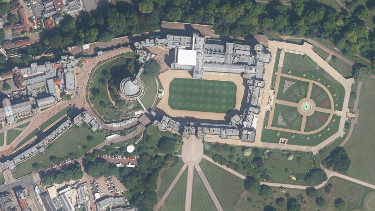
Road markings and street furniture
“In simple terms the resolution of imagery determines what you can see and identify within the digital dataset, in other words the level of detail,” added Tidmarsh. “So, within a 12.5cm resolution image each individual pixel relates to 12.5 centimetres in the real world. This means that features such as road markings, street furniture, vegetation and property infrastructure are all visible and easily identifiable opening up even more applications for the data.”
Headquartered in rural Leicestershire, close to its East Midlands Airport flying base, Bluesky International is the leading independent aerial survey and geographic data company in the UK. With national contracts with government and commercial organizations Bluesky already maintains seamless digital aerial photography on a countrywide scale, at a variety of resolutions, together with simultaneously captured Colour Infrared (CIR) imagery.
3D models of the Earth’s bare surface (Digital Terrain Model / DTM) and surface features such as buildings and trees (Digital Surface Model / DSM) are also created from the aerial photography by Bluesky’s skilled and experienced team. Bluesky has also developed a range of derived products including the innovative National Tree Map and 3D Building Models.

Value staying current with geomatics?
Stay on the map with our expertly curated newsletters.
We provide educational insights, industry updates, and inspiring stories to help you learn, grow, and reach your full potential in your field. Don't miss out - subscribe today and ensure you're always informed, educated, and inspired.
Choose your newsletter(s)


