BRICS-country Project to Develop 3D Modelling Software for Urban Infrastructure Management
Researchers from Russia, China and India will soon be working together within a project to develop software for the informative 3D modelling of urban infrastructure using laser scanning technology combined with photographic images. The project recently won the BRICS STI Framework Programme, a competition for international consortia in the field of science, technology and innovation from the BRICS countries (Brazil, Russia, India, China and South Africa). The software will be useful at all stages of the urban infrastructure lifecycle, including the detection of defects, building information modelling (BIM) and carrying out renovation work.
Specialists from Peter the Great St. Petersburg Polytechnic University (SPbPU), in collaboration with the East China Normal University and the Indian Institute of Technology Roorkee, will now work to develop software for the analysis of 3D images of infrastructure objects. The data is collected using laser scanner survey technologies and photography techniques.
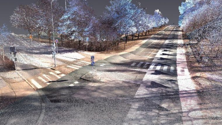
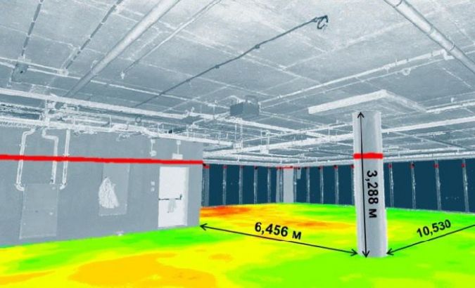
Point cloud analysis
“In cooperation with our international colleagues, we will analyse point clouds obtained by laser scanning and develop software that enables recognition of the particular features of the materials, the texture of the objects and any changes. Our developments can be used for monitoring and repair of infrastructure such as roads, as well as for the preservation of cultural and historical heritage sites,” said Vladimir Badenko, professor from the Institute of Civil Engineering at SPbPU.
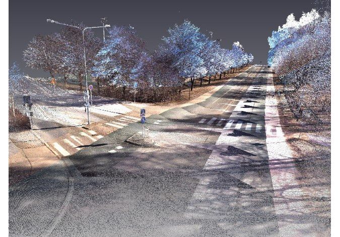
The international team of scientists will develop the tools for processing the raw data from laser scanning surveys, initially transforming the information about the object into point clouds of suitable density. To visualise the point clouds, researchers are combining projections of the images with photographic data. This significantly improves the segmentation quality of laser-scanned point clouds. Using such projections for object modelling enables all 3D data to be displayed on an aircraft’s monitor and, accordingly, the quality and processing speed to be improved. In addition, it helps users to adjust the required display scale of the object and to obtain the most accurate image (without shadows).
A significant amount of data is being processed using the facilities at SPbPU’s Supercomputer Centre.

Value staying current with geomatics?
Stay on the map with our expertly curated newsletters.
We provide educational insights, industry updates, and inspiring stories to help you learn, grow, and reach your full potential in your field. Don't miss out - subscribe today and ensure you're always informed, educated, and inspired.
Choose your newsletter(s)


