Building Geometry Model Software for Better Risk Analysis
Geoscience Australia has released new open source software, produced as part of a recently completed international capacity-building project in the Philippines, which can rapidly and remotely assess the geometric properties of buildings. The Building Geometry Model software was developed to help obtain vital information about the size and shape of buildings for the Greater Metro Manila Area in the Philippines.
This capacity building programme involved staff from Geoscience Australia who worked with local counterparts from the Government of Philippines to develop assessments of how floods, severe winds from tropical cyclones and earthquakes will impact on Manila.
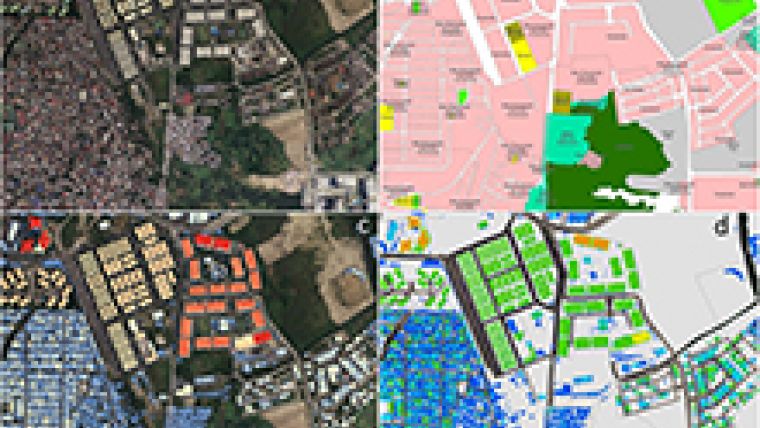
The Greater Metro Manila Area is a very complex urban environment, with over 12 million people living within a land area of about 600 square kilometres. This is equivalent to approximately half the area of greater Sydney, but with more than five times the population density. The Greater Metro Manila Area is growing rapidly, with land use patterns also changing at an equally rapid pace. Subsequently it can be extremely difficult to rapidly and reliably take stock of the number and type of buildings in such complex and densely populated urban environments.
Geoscience Australia spatial analyst Matthew Jakab said that one of the main objectives of the project was to understand the potential physical and economic impact on buildings of flood, earthquakes and wind hazards from tropical cyclones, as well as to estimate the likelihood of associated injury or loss of life to the population of Greater Metro Manila Area.
Geometric characteristics
This part of the project aimed to develop better understanding of the geometric and structural characteristics of the building stock involved, Jakab said. This involved assessing the qualitative attributes of buildings such as the purpose, style, age and construction materials of the buildings via on-ground surveys, records in government databases, and local knowledge or expert judgement, he added. Alternatively, the geometric properties of buildings may be accessed from existing spatial datasets, or they can be directly or remotely measured via aerial surveys, Jakab continued.
Lidar and 4-band (colour + Infra Red) aerial imagery data was captured via an aerial survey of the Greater Metro Manila Area, resulting in the collection of billions of individual data points. The Lidar data was further processed to derive Digital Elevation Model and Digital Surface Model raster datasets.
By combining information on hazard, exposure and vulnerability, the risk posed by the hazards can be calculated and expressed in terms of expected physical damage, economic loss and potential casualties, Jakab concluded.
The resulting open-source software provides a more accurate and rapidly acquired assessment of the building stock. The tool has already been shared with Geoscience Australia’s partners in the Government of the Philippines, where it was fundamental to exposure information development for the risk analysis project in Manila, and with collaborators in the Global Facility for Disaster Risk Reduction at the World Bank.

Value staying current with geomatics?
Stay on the map with our expertly curated newsletters.
We provide educational insights, industry updates, and inspiring stories to help you learn, grow, and reach your full potential in your field. Don't miss out - subscribe today and ensure you're always informed, educated, and inspired.
Choose your newsletter(s)


