Capturing the World with 3D Technology
After months of planning, a specialist mapping company from Liverpool, UK, is launching its new brand, website and specialist solutions for asset data capture, 3D modelling and unmanned aerial services. MGISS delivers a full range of geospatial solutions and services that help businesses capture, create, analyse and visualise spatial data.
Industries such as energy, water, engineering contractors, environmental services consultants and facilities management providers can significantly improve the way they work in the field and add value to client projects, by using integrated smart devices and software which can provide return on investment within a single project and massive productivity gains, the company states.
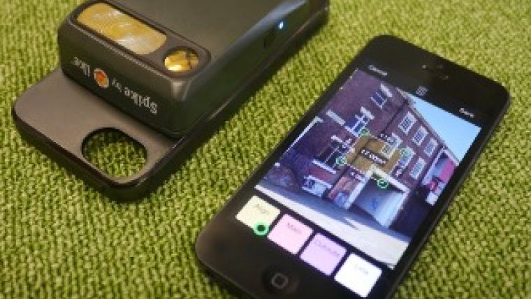
One of the company’s latest developments uses a smartphone laser rangefinder (Spike) which enables to measure directly from images and quickly provide information for planning, 3D modelling and inspection reporting. To time with the company’s re-launch, MGISS is also exhibiting at some large industry events, including the GeoDATA 2014 London Mapping Show, which is being held on December at the ILEC Conference Centre. MGISS will be giving a presentation to over 700 delegates about Integrated Mobile Mapping – Getting Real Value from data – at about 1.30pm.
MGISS is also running its own series of geospatial training courses which are targeted to everyone who is looking to implement a mapping solution or get maximum value from their existing equipment.

Value staying current with geomatics?
Stay on the map with our expertly curated newsletters.
We provide educational insights, industry updates, and inspiring stories to help you learn, grow, and reach your full potential in your field. Don't miss out - subscribe today and ensure you're always informed, educated, and inspired.
Choose your newsletter(s)


