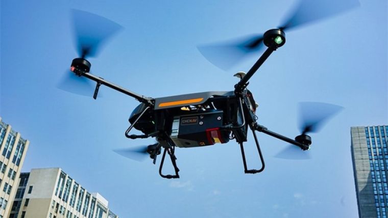
CHC Navigation Introduces Airborne Lidar Series
CHC Navigation (CHCNAV) has released the AlphaAir 1400 (AA1400) and AlphaAir 2400 (AA2400) Lidar systems. Both solutions are compact airborne laser scanners that are easily installed on various UAV platforms or small survey aircraft and helicopters. They are ideally adapted to high-density point corridor mapping applications, day or night, under leaf-on and leaf-off conditions or with dense vegetation to provide reliable results.
“Nowadays, it is critical to obtain the highest data quality for the majority of aerial survey projects. In addition to state-of-art GNSS and IMU sensors, the AA1400 and 2400 also integrate RIEGL’s VUX Lidars with their unique Waveform-Lidar technology, allowing echo digitization and online waveform processing. Multi-target resolution is the basis for penetrating even dense foliage,” said Andrei Gorb, product manager of CHC Navigation’s Mapping and Geospatial Division. “The continuously rotating polygonal mirror wheel enables scanning speed of up to 400 lines per second, allowing for effective coverage of large areas when used from fast drones or aircraft.”
High-accuracy Aerial Laser Scanning and Oblique Imagery
Combining with industrial-grade GNSS and high precision IMU systems, the AA1400 and 2400 provide a 2 to 5cm survey-grade accuracy. Their built-in premium RIEGL VUX-120 and VUX-240 Lidar sensors feature a high-speed data acquisition rate of up to 1.8MHz and scan speed up to 400 lines per second. It provides linear accuracy of 1 to 2cm on long-range scanning and perfectly suits the fixed-wing UAV corridor mapping application.
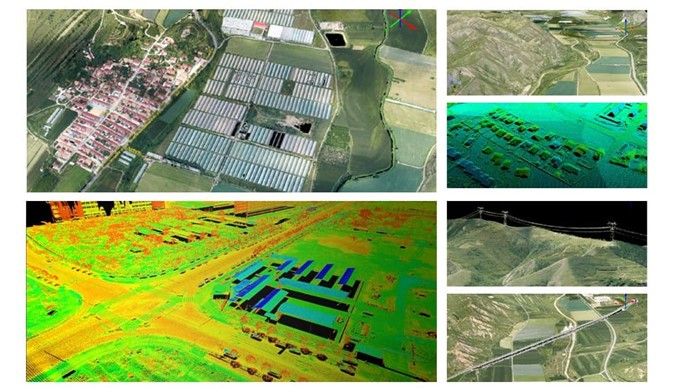
CHCNAV offers several external camera add-ons for the AlphaAir. Users can choose from 42, 100 or 150MP fully calibrated sensors for data acquisition. And setups can include nadir or nadir and oblique cameras from Sony or Phase One. By obtaining high-resolution georeferenced and oblique imagery, more applications can be supported, aimed at increasing the return on investment for the client.
The one-click connection of the AlphaPort to the power source and camera makes the installation of the AA1400 and 2400 very quick and easy, eliminating the need for additional accessories and time for camera calibration. The AA1400 and 2400 reduce the risk of cable damage caused by aircraft vibration and acceleration during takeoff and landing.
CHCNAV provides a full range of solutions that allows a complete Lidar solution to be added to the users’ geomatic services. The software suite includes CoCapture UAV field application for fully automated reality capture and real-time mission tracking, and the CoPre desktop software for semi-automated point cloud processing.

Value staying current with geomatics?
Stay on the map with our expertly curated newsletters.
We provide educational insights, industry updates, and inspiring stories to help you learn, grow, and reach your full potential in your field. Don't miss out - subscribe today and ensure you're always informed, educated, and inspired.
Choose your newsletter(s)


