CHC Navigation Introduces New GNSS RTK Tablet
This article was originally published in Geomatics World.
CHC Navigation has announced the availability of the LT700H RTK Android tablet designed to increase the efficiency and productivity of a mobile field workforce in any applications requiring centimetre to decimetre positioning accuracy. Portable, rugged and versatile, the LT700H enables precision GIS data collection, forensic mapping, construction site layout, environmental surveys, landscaping and earthmoving jobs.
Powered by 184-channel high performance GPS, Glonass, Galileo and BeiDou module and superior tracking GNSS helical antenna, the LT700H provides best-in-class position availability in demanding environments. Its integrated 4G modem ensures seamless communication from field-to-office and robust connectivity to GNSS RTK networks corrections.
“With the LT700H RTK Tablet, we are offering a professional and accurate GNSS solution to any mobile applications requiring high-portability,” said George Zhao, CEO of CHC Navigation. “The LT700H enables further use of GNSS technology, from a single operator to companies with a large field crew.”
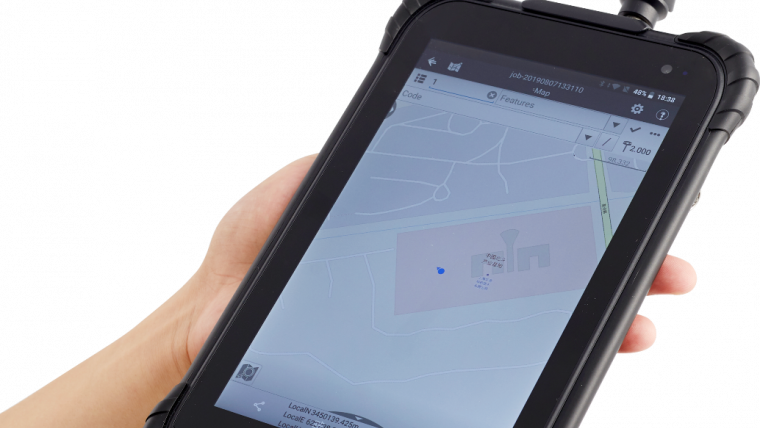
Combined with CHCNAV Landstar 7 field data collection software, the LT700H vibrant 8” IPS sunlight-viewable screen perfectly displays any GIS data tables, vector and raster maps or high-resolution pictures. The LT700H Google GMS certification guarantees compatibility with any common GIS and mapping Android applications.

Value staying current with geomatics?
Stay on the map with our expertly curated newsletters.
We provide educational insights, industry updates, and inspiring stories to help you learn, grow, and reach your full potential in your field. Don't miss out - subscribe today and ensure you're always informed, educated, and inspired.
Choose your newsletter(s)


