ComNav Tech launches rodless GNSS receiver for precision surveying
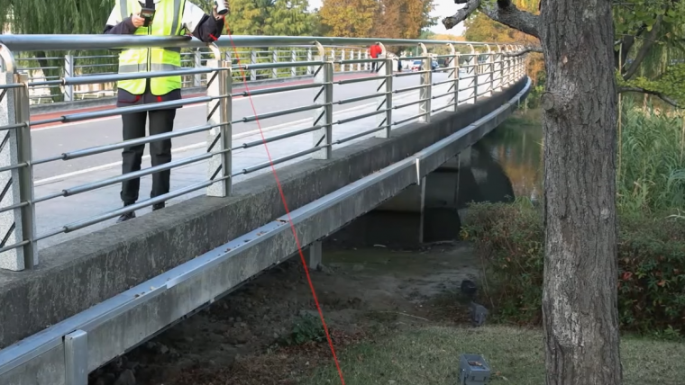
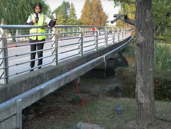
ComNav Technology has introduced a new product called Venus Laser RTK, which allows positioning without the need for a range pole. For the prism-free total station, the principle behind this technology is that the laser beamer on the total station sends a laser pulse towards an object and measures the time taken for the pulse to be reflected off the object and returned to the transmitter. This enables the distance between the transmitter and object, as well as the coordinates of the object, to be determined.
The Venus Laser RTK GNSS receiver is equipped with a centimetre-level laser rangefinder on the bottom, with which it determines the distance between the RTK and the object. It can obtain centimetre-level positioning results through the CORS network. Furthermore, the IMU sensor allows tilt compensation within 60° tilt, making it easy to obtain accurate coordinates. This feature solves problems such as mapping dangerous or obstructed areas, breaking the usual limitations. In terms of laser safety, the laser is Class 3R, which is considered safe when handled carefully.
Venus Laser RTK is a pure network RTK, which means that it is extremely light and convenient for surveyors who require small RTKs. Additionally, it is equipped with a millimetre-level laser, which can replace the range pole during stakeout and measurement, expanding the scope of work and ensuring user safety.
With the built-in IMU sensor, Venus Laser RTK can maintain high-precision results with tilt compensation, detecting micro accelerations that are generated from the laser point or the range pole. It tracks 1,590 channels for all running satellite constellations and supports the SBAS PPP service. The new K8 platform has a stronger computing capability and lower power consumption.
Versatile tool for a multitude of applications
The Venus Laser RTK is a versatile tool with various applications, including land surveying, construction and mapping. Its ability to obtain centimetre-level positioning results without the usual limitations makes it useful in situations where the use of range poles is impractical or impossible. It can be used for building layout, setting out control points, monitoring deformation, boundary surveys, topographic surveys, site control and stakeout in difficult or unsafe areas. The built-in IMU sensor even enables accurate measurements on rough terrain or in areas with limited access. Overall, the Venus Laser RTK is a powerful tool that enhances the efficiency and accuracy of various applications in surveying, construction and mapping.

Value staying current with geomatics?
Stay on the map with our expertly curated newsletters.
We provide educational insights, industry updates, and inspiring stories to help you learn, grow, and reach your full potential in your field. Don't miss out - subscribe today and ensure you're always informed, educated, and inspired.
Choose your newsletter(s)


