Conserving Biodiversity with GIS
As environment becomes the top issue in every country, governments and scientists are eager to find the balance between development and environment protection. GIS, as the key solution, offers various possibilities to observe and manage natural resources.
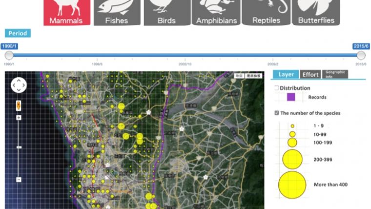
Therefore, Kaohsiung City Government, Taiwan, authorised Supergeo to build Kaohsiung City Biodiversity Database, including species information to monitor the distribution of animals to enhance the conservation of biodiversity.
Integrated with database, GIS tech and user-friendly interface, Kaohsiung City Biodiversity Database successfully reveals the geographical distribution in a convenient way to read, not only for the government, but also for educational facilities and the public. Also, the distribution condition of species revealed on the map helps users to further comprehension about ecological conservation.
Crucial role
Furthermore, the biodiversity statistical analytical data enables researchers to timely get the variation tendency of species, and revise the aspects about conservation planning and development. The continually updated and timely database plays a crucial role in planning the biodiversity conservation policy of Kaohsiung City.
Powered by Supergeo team, the database brings the convenient geospatial technology application to the public and researchers, and brings GIS application for sustainable uses.

Value staying current with geomatics?
Stay on the map with our expertly curated newsletters.
We provide educational insights, industry updates, and inspiring stories to help you learn, grow, and reach your full potential in your field. Don't miss out - subscribe today and ensure you're always informed, educated, and inspired.
Choose your newsletter(s)


