Construction Data Management
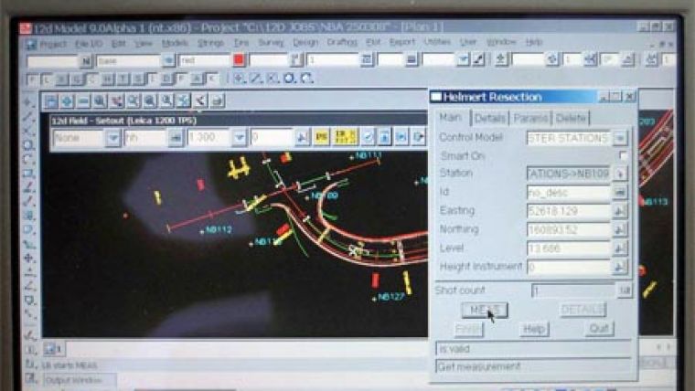
Especially for the construction industry, 12d Solutions have developed 12d Field. This software module allows users to view and utilise entire project models in the field, enjoy real-time set out and pickup capability, import and export to all major file types and interface with most survey instruments.
After 3 years of development and over 18 months of rigorous onsite testing on some of the largest construction sites in Australia, 12d Field is only now being released internationally.
Previously surveyors onsite had access to only a small amount of data which was pre loaded (into a controller) and viewed via a very basic display. 12d Field, gives users access to the entire project in high resolution.
Projects can be viewed and edited (including all strings, points, aerial photographs), dynamically in either plan, section or 3-D perspective views. Project files can be sent directly from the field (emailed via onboard 3G cards) to the office in a variety of file formats, some which ensure zero data loss (especially attribute information).
Currently 12d Field supports the major GPS receivers and many high-end motorised TPS instruments on the market.

Value staying current with geomatics?
Stay on the map with our expertly curated newsletters.
We provide educational insights, industry updates, and inspiring stories to help you learn, grow, and reach your full potential in your field. Don't miss out - subscribe today and ensure you're always informed, educated, and inspired.
Choose your newsletter(s)


