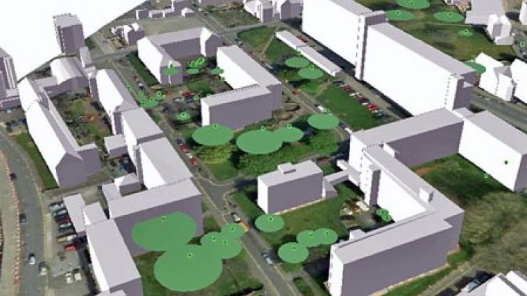
Digital Map of Trees
Bluesky has launched a digital map layer accurately modelling the location and extent of trees and their proximity to buildings. Designed to aid insurance assessors, property developers and Local Authority Planners, ProximiTREE details the exact spatial location and height of individual trees together with the circumference of its canopy. From this information a determination can be made of the root extent and the potential impact on either existing or proposed properties.
Building subsidence is estimated to cost the insurance industry in excess of GBP500 million after each dry year and is usually the second most expensive insured peril after fire. Concern about the location of trees is a major worry to house owners, not only when trees cause damage through subsidence but also because the proximity of trees can jeopardise house purchases, insurance claims, planning applications, mortgage loans and even cause disputes between neighbours.
ProximiTREE is derived from the most accurate and up to date aerial photography. Using overlapping images the exact location of every tree can be mapped and the height and extent of its canopy derived. ProximiTREE is suitable for use in most desktop Geographical Information Systems (GIS), web mapping applications and Computer Aided Design (CAD) packages. Both 2D and 3D versions of the map are available and ProximiTREE works alongside existing Bluesky datasets such as 3D buildings, terrain models and aerial imagery.

Value staying current with geomatics?
Stay on the map with our expertly curated newsletters.
We provide educational insights, industry updates, and inspiring stories to help you learn, grow, and reach your full potential in your field. Don't miss out - subscribe today and ensure you're always informed, educated, and inspired.
Choose your newsletter(s)


