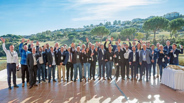
EAASI Summit Demonstrates the Essential Role of Aerial Surveying in Today’s Challenges
The role of aerial surveying in the technological response to challenges such as the global pandemic, climate change and societal issues was discussed at the EAASI Partners Summit in Malaga, Spain, from 8-10 December 2021.
Representatives of 30 organizations from around the world attended a series of presentations, workshops and networking events to learn more about the aerial surveying industry and the opportunities for sustainable development, while also considering barriers to the use of aerial mapping-derived intelligence.
In his opening speech, Simon Musäus, president of the European Association of Aerial Surveying Industries (EAASI), highlighted the importance of the association and of strong business relationships in the continuous evolution of the industry. He also emphasized the association’s mission to ‘make aerial surveying sustainable’ and called on the delegates to reinforce their unity in order to strengthen the relevance of aerial surveying for future generations.
Geospatial data as DNA of everyday life
Keynote speaker Ed Parson, a geospatial technologist at Google, explored geography ‘behind the scenes’, presenting examples of how geospatial data is the interface to additional content and the DNA of many day-to-day activities. He also described concepts such as the ethics of geography, the ‘Covid Catapult’, and how technology – and specifically geographic technology – has the potential to make people’s lives better.
Other highlights of the three-day summit included a lively panel discussion featuring leading aircraft manufacturers, and an investigative workshop facilitated by The Next Lab. Diving deeper into the aerial surveying industry of today, participants developed proposals for roadmaps that will guide EAASI’s future strategy. Additional presentations were given by Barbara Ryan representing the World Geospatial Industry Council, Bob Hanson of MAPPS, and Alberto Gaspar-Martin of the Spanish Aviation Safety and Security Agency (AESA).
The benefits of personal contact
“After a period of isolation, it was amazing to realize once again how much personal contact boosts productivity in developing relationships and understanding complex issues,” commented EAASI President Simon Musäus. “I must therefore thank everyone involved in this event. By coming together as an industry, we have been able to move forward as a representative association with a defined set of ambitions and the activities required to achieve them.”
The 2021 EAASI Partners Summit was sponsored by CAE Aviation, Diamond Aircraft, Hexagon Geosystems, Phase One, RIEGL, Teledyne and Vexcel Imaging. The sponsors also contributed with commercial presentations and discussion panels.
EAASI, which has 45 active member firms and 14 observers, represents the European aerial surveying market. With the global aerial imaging market predicted to reach more than six billion dollars by 2027, the association aims to promote the benefits of aerial surveying, improve awareness of aerial survey data and maintain and promote best practices within the industry.

Value staying current with geomatics?
Stay on the map with our expertly curated newsletters.
We provide educational insights, industry updates, and inspiring stories to help you learn, grow, and reach your full potential in your field. Don't miss out - subscribe today and ensure you're always informed, educated, and inspired.
Choose your newsletter(s)


