Environmental Compliance Monitoring for Nickel Mine Project
GAF AG, Germany, has made a successful contribution to Ambatovy’s biodiversity programme by applying Earth observation technology to the monitoring of forest habitats of the Republic of Madagascar. The information derived contributes significantly to knowledge about prevailing deforestation rates along Madagascar’s eastern rainforest corridor, parts of which have World Heritage status.
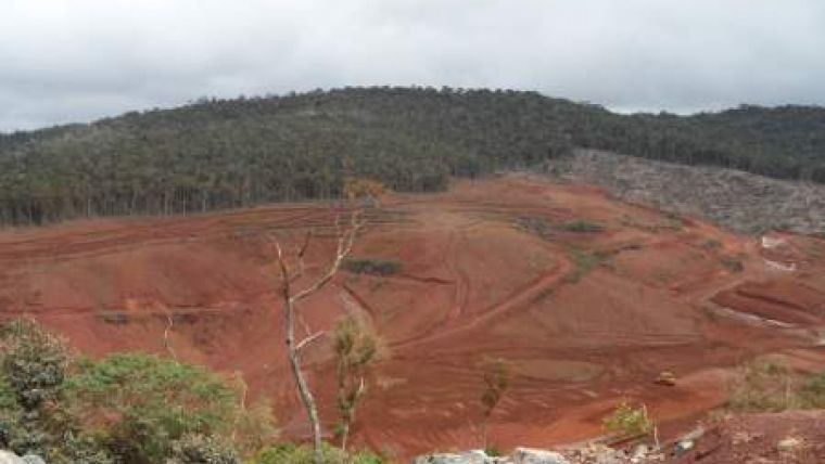
Ambatovy in Madagascar is one of the largest mining and processing projects in Sub-Saharan Africa. With a planned production of 60,000 tonnes of refined nickel and 5,600 tonnes of refined cobalt per year, Ambatovy will soon rank among the largest lateritic nickel mining entities in the world. The mine is located 80 km east of Madagascar’s capital Antananarivo at the southern end of the eastern rainforest corridor, an area of humid forest with unique flora and fauna. A large and complex mosaic of forest and agricultural land surrounds the mine, all of which feature high biodiversity. The project’s industrial sites (plant, tailings management facility and harbour extension) are located 130km to the northeast of the mine site, at the port city of Toamasina. A pipeline connects the mine to the processing plant, which transports the slurry, a mixture of ore and water. Several forest conservation areas are situated within the Ambatovy Project region. These are located around the mine site, on the pipeline corridor and in the Ankerana forest, an off-site offset area located northeast of the mine and linked to the eastern rainforest corridor.
In order to preserve the biodiversity of this unique environment, the Ambatovy Project has developed a comprehensive biodiversity mitigation and conservation plan. This includes the establishment of on-site and off-site conservation areas or “offsets”, thereby ensuring that impacts of the mining are minimised. Residual losses are offset resulting in no net loss and preferably a net gain in biodiversity over the operating time of the project.
In support of Ambatoy’s ambitious and innovative biodiversity offsets programme, GAF performed a land cover analysis using recent and historic satellite data. The focus of GAF´s intervention was to evaluate prevailing forest change between 2006 and 2011 in the Ambatovy Project region and at target conservation sites. Analogue and digital land cover and land cover change maps were produced for the mine site, the pipeline corridor and the forest conservation areas. This information was then utilised to identify forest change, quantify the amount of forest loss, specify the land use classes to which forest was transformed and report on the success of conservation efforts. Data collected on-site were used for training and verification purposes.

Value staying current with geomatics?
Stay on the map with our expertly curated newsletters.
We provide educational insights, industry updates, and inspiring stories to help you learn, grow, and reach your full potential in your field. Don't miss out - subscribe today and ensure you're always informed, educated, and inspired.
Choose your newsletter(s)


