European Lidar Mapping Forum Attracts Record Number of Visitors
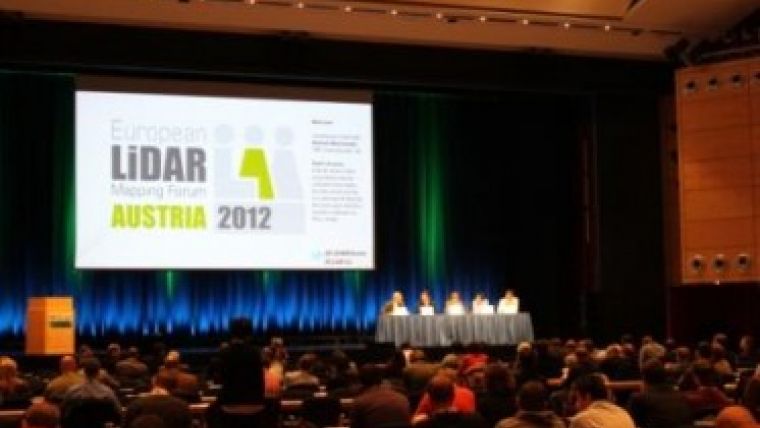
Around 450 delegates from 45 countries gathered for the ELMF at the Salzburg Congress Centre, where presentations were delivered by the world’s leading Lidar experts. Focusing on the use of Lidar to support transport, urban modelling, coastal zone mapping, asset management, 3D visualisation and GIS applications, contributed to the success of the third ELMF held from 4 to 5 December 2012.
Delegates were also able to visit ELMF’s largest exhibition yet, with more than 50 top global hardware/software manufacturers and service providers, live demonstrations, and a selection of mobile mapping vehicles operating in real time as they went about the city of Salzburg capturing map data.
The conference plenary session was opened by Alastair MacDonald, chairman of TMS International, who noted that the industry is experiencing a challenging time, in common with the wider economies of Europe. This is, however, simultaneously driving new technologies and applications, which are about to significantly change the market by enabling faster, better and cheaper deliverables to end users. In particular, the market drivers are now leading on-the-fly processing of captured Lidar and imagery data, followed by its fast transformation into accessible and manageable visualisation systems.
The conference enjoyed a thought-provoking keynote presentation by Lawrie Jordan, director of Imagery at ESRI, world leaders in GIS platform technology. For example, Mr Jordan outlined how remotely sensed data can be transformed through GIS into intelligent 3D images for use in
the cloud or in augmented or virtual reality.
In the open debate session, a panel of distinguished representatives from the Lidar technology and services community gave their views on two industry technology issues. Firstly, the panel considered whether too much data was being provided unnecessarily to the end users, and
secondly whether the industry was investing sufficiently to meet end user demands to manipulate and manage data themselves.
The technical conference was considered by everyone to be the most successful yet with 35 stimulating and informative papers. Topics were broad and included first announcements about new cutting-edge sensors such as the new Chiroptera bathymetric Lidar scanner from the Swedish company, Airborne Hydrography, which pushes the frontier of clear water penetration down to 20 metres. Fugro Pelagos’ new techniques for underwater mapping of vegetation types also illustrated an innovative way of monitoring marine health.
Ken Bragg from Safe Software, Canada, illustrated how Lidar data can add a valuable 3D dimension to GIS data. He also advocated open source tools to read and write compressed format data. This was a theme picked up by LAStools’ Martin Isenburg, the internationally known expert in data compression, who announced the arrival of new capabilities to store the full Lidar waveform data. Francesco Pirotti of the University of Padua, Italy, described the potential of pre-processing waveform data to extract 3D representations of the return pulse intensity as well as of derived metrics.
Resolution and accuracy remain key issues as data processing techniques become ever more refined. Professor Bob Pack of Utah University described a process being trialled whereby a pre-calibration 10cm resolution was improved to 1.2cm after application of a series of calibration/adjustment steps, which also led to an improvement in the point cloud accuracy. Robert Marschallinger of Salzburg University explained how to convert Lidar point clouds into solid models for quantifying volume in a unique open mining drilling programme. Gerald Forkert of
Austria’s UVM Systems focused on how the use of Lidar data in 3D simulation assists new planning proposals for local communities. Alexander Wiechert of Microsoft Vexcel, delivered a challenging paper on digital imaging as an alternative to Lidar for generating point clouds.
The papers on recent projects were truly diverse: mapping the world’s first iron bridge in HD; using Lidar measurements to improve road safety; flying the latest unmanned aerial vehicles as sensor platforms; mapping missions in Africa and the frustrating challenges of continuously
delayed government permission for flying missions. Each speaker described the practice and results and, importantly for the delegates, the lessons learned.
ELMF’s workshops for training and career development were in great demand, delivering updates on a wide range of specialist topics. Two presentations were of particular note: Italy’s Gexcel illustrated how very large point clouds can be synchronised with HD video; and Lewis Graham of US GeoCue delivered a visionary exposition of how semi-global matching techniques [SGM] are becoming increasingly popular to create 3D data, and how the differences in SGM and Lidar data cause processing tools to behave in unexpected modes. Dr Graham Hunter, from 3D Laser Mapping in the UK, led a workshop devoted to urban mobile mapping and the latest developments in indoor mobile mapping.
ELMF’s conference director, Versha Carter, was glad about the success of this year’s ELMF. Speakers delivered outstanding papers covering a wealth of subjects and containing a great deal of information. The venue in Salzburg once again attracted global interest and its seasonal events provided an extra special social dimension.
The US series of the same conference, the International Lidar Mapping Forum, will take place in Denver, USA on 11-13 February 2013. Further information is available at: www.lidarmap.org.

Value staying current with geomatics?
Stay on the map with our expertly curated newsletters.
We provide educational insights, industry updates, and inspiring stories to help you learn, grow, and reach your full potential in your field. Don't miss out - subscribe today and ensure you're always informed, educated, and inspired.
Choose your newsletter(s)


