FARO Acquires Mobile Mapping Pioneer GeoSLAM
FARO has announced the acquisition of one the world's mobile scanning market leaders: GeoSLAM. With proprietary high-productivity simultaneous localization and mapping (SLAM) software to create 3D models for use in digital twin applications, the addition of GeoSLAM will put FARO in an excellent position to significantly expand and accelerate market growth opportunity in the mobile scanning space.
With the purchase of GeoSLAM, FARO now offers an impressive broad set of 4D data capture solutions, ranging from 360° camera-based images to mobile scanning, to stationary high-accuracy laser scanning, allowing customers to balance the need for accuracy, speed and detail depending on the requirements for their applications and workflows. When combined with the recently announced FARO Sphere cloud-based collaboration platform, these capture technologies provide the foundation for the 4D digital reality-based SaaS offering that will allow customers to access multiple 4D data sources for visualization and analysis through a single-user experience.
FARO is widely regarded as a trusted source of high-precision 3D measurement, imaging and visualization technology. In the surveying and mapping field, the company is particularly well known for its Lidar-based solutions. GeoSLAM has rapidly gained ground over the past decade – the company was founded in 2012 – with its groundbreaking portable and mobile mapping solutions.
SLAM Technology
A technology first developed in the robotics industry, SLAM enables tools to scan indoors or other difficult-to-reach, enclosed spaces. Using information from sensors, normally Lidar and imagery, digital 3D maps can then be created based on the location of the device, without the need for GPS.
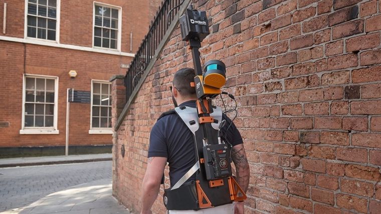
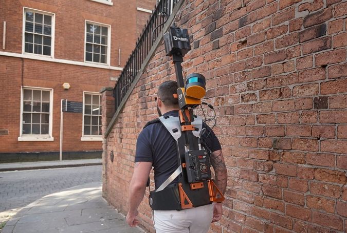
SLAM-enabled mobile, lightweight scanners such as GeoSLAM’s ZEB Revo RT or ZEB Horizon can allow teams to map and monitor sites quickly on foot or with drones. With a handheld mobile mapping device using SLAM, any member of the site team can operate with minimal training required. The ZEB-HORIZON for example, has a ‘walk and scan’ method of data collection, capturing 300,000 points per second, with an ability to capture distant features at a range of 100 metres.
Mobile Mapping as a Driver for Growth
“We are thrilled to add GeoSLAM’s handheld 3D scanning technology to our portfolio of cutting-edge data capture solutions,” said Michael Burger, FARO president and CEO. “We welcome the GeoSLAM team to our FARO family.” Andy Parr, GeoSLAM CEO, added: “Joining with FARO represents the next step in the growth of GeoSLAM and the establishment of mobile mapping as a driver for growth in the way businesses map and understand their spaces. Both companies share a vision of the importance of mobile scanning in the burgeoning digital reality capture market.”

Value staying current with geomatics?
Stay on the map with our expertly curated newsletters.
We provide educational insights, industry updates, and inspiring stories to help you learn, grow, and reach your full potential in your field. Don't miss out - subscribe today and ensure you're always informed, educated, and inspired.
Choose your newsletter(s)


