Field-to-Finish SurveyMaster
Field-to-finish control of critical data flow from data collection, raw file analysis and engineering design to final print is offered in new versions of SurveyMaster and SurveyMaster Lite 1.3.1 from Topcon Positioning Systems' (TPS, USA).
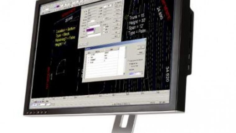
SurveyMaster Lite contains land survey-specific functionality as well as a CAD drafting engine. Cogo, drafting tools, survey data editors and adjustments, deed entry, legal description writer and contouring are provided. Version 1.3.1 is designed to improve the support and representation of field data using Topcon field software. Among the improvements for both SurveyMaster and SurveyMaster Lite v1.3.1 are program attribute library containing attribute definitions for points, lines, polygon areas and unlimited user-defined attributes for project lines, points and polygon areas; revised survey code attribute definitions; improved TopSurv file linework support; improved Text/ASCII point file import; improved AutoCAD dwg support; improved Import/Export of 3DMC TP3 files; and new survey code interface and format.

Value staying current with geomatics?
Stay on the map with our expertly curated newsletters.
We provide educational insights, industry updates, and inspiring stories to help you learn, grow, and reach your full potential in your field. Don't miss out - subscribe today and ensure you're always informed, educated, and inspired.
Choose your newsletter(s)


