Finland to Improve Situational Awareness of GNSS with Research Expertise
The National Emergency Supply Agency and the National Land Survey of Finland have joined forces to ensure the security of satellite positioning services in the country. A project has been launched in which the Finnish Geospatial Research Institute of the National Land Survey of Finland will study and improve the situational awareness of such positioning in order to guarantee its safety.
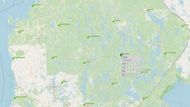
GNSS signals can be weak and therefore prone to interference. Such interference can be triggered by a number of factors, both natural and man-made. As such, the quality of satellite positioning signal in Finland is monitored by the GNSS-Finland service, developed by the National Land Survey of Finland and funded by Traficom.
Level of Preparedness
This new project will further develop the GNSS-Finland service by identifying the services and format that end-users need. Senior Preparedness Specialist Tuomas Seppälä of the National Emergency Supply Agency noted that: “An increasing number of sectors essential to the functioning of society make use of positioning and timing data from satellites. However, the GNSS services that transmit this data are susceptible to interference, and this cooperation will help us improve our level of preparedness.”
The Department of Navigation and Positioning of the Finnish Geospatial Research Institute, which is internationally recognized for its research, methodology and development in this field, will provide a dedicated unit to support the security of supply of satellite positioning. The project will run from 2022 to 2023, and is funded by the National Emergency Supply Agency’s Digital Security 2030 programme.
The improved GNSS service will make more efficient use of existing infrastructure, and the situational awareness will be tailored to each user's needs. Traficom is responsible for providing the situational awareness of GNSS and will ensure that radio frequencies are monitored and interference-free.
Read the original and more extensive version of the story here

Value staying current with geomatics?
Stay on the map with our expertly curated newsletters.
We provide educational insights, industry updates, and inspiring stories to help you learn, grow, and reach your full potential in your field. Don't miss out - subscribe today and ensure you're always informed, educated, and inspired.
Choose your newsletter(s)


