Geokosmos Conducts French Railways Lidar Survey
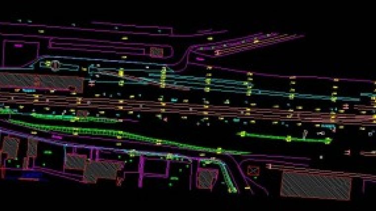
Geokosmos (Russia) has completed Lidar survey of French national railways in France., using combined airborne laser scanning and digital aerial photography technology.
The company surveyed that part of the railroads which connects Amiens and Bouillon and covers an area of 83km. The captured data was used for producing a large-scale digital topographic map (scale 1:500) and a digital orthophoto (GSD 5cm) that will help French National Railways Service provide technical assessment of the French railways and its infrastructure.
Given tough requirements set up by the customer with regards to the accuracy of captured data, aerial laser scanning combined with aerial digital photography was conducted with high density of laser points - 7 points per 1 sq. m. Planimetric and height and accuracy constituted 5cm.

Value staying current with geomatics?
Stay on the map with our expertly curated newsletters.
We provide educational insights, industry updates, and inspiring stories to help you learn, grow, and reach your full potential in your field. Don't miss out - subscribe today and ensure you're always informed, educated, and inspired.
Choose your newsletter(s)


