GIS 2go Accesses ArcGIS Maps Offline From Tablets
The service GIS 2go by Disy Informationssysteme, Germany, transfers maps from ArcGIS Desktop to tablets (Android or iPad), providing users with access to all GIS and media data wherever they are, even when offline.
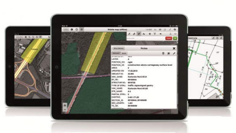
The GIS 2go add-in for ArcGIS Desktop supports data selection, map export and re-import via the cloud. With the app "Cadenza Mobile GIS 2go" installed on a tablet, users have immediate access to their maps, including all attribute data and media – even if they are offline in the field. Graphic notes and media created on the go can also be imported back into ArcGIS Desktop.
Users can interactively navigate on the map while on the go. It is possible to show attribute data and use the graphic notebook to add points, lines and areas or track them via GPS. This information can be complemented with photos and audio/video recordings or text notes. Data captured on the go can easily be imported into ArcGIS Desktop and stored to the local database or file system.
Saving and using mobile maps on a tablet is described in four steps. A personal demo account is offered for interested users in order to test GIS 2go on their mobile device.

Value staying current with geomatics?
Stay on the map with our expertly curated newsletters.
We provide educational insights, industry updates, and inspiring stories to help you learn, grow, and reach your full potential in your field. Don't miss out - subscribe today and ensure you're always informed, educated, and inspired.
Choose your newsletter(s)


