Gyrocopter for Geodesy and Surveillance
Due to massive price pressure on service providers of airborne data on the one hand and the decreasing budgets of customers like surveillance companies, public authorities, insurance companies, scientific institutes and others on the other hand, the Munich company DiNelly Aerosystems has developed a gyrocopter especially for application fields like geodesy, reconnaissance and surveillance.
With a special view on topics like optimised lightweight construction, space volume, cost structure, versatility and easy handling this new conceived aircraft is outstanding.
This gyrocopter will be certified in Germany as UL (ultralight) with an empty weight of less than 265kg / 560kg MTOW. The flight system however is calculated for worldwide missions up to 700kg MTOW and max. 5 seats OR pilot + operator + 1,6m³ compartment. A new design concept and the consequent use of aviation certified high-tech materials enable this quantum leap in the consensus of UL-gyrocopter. It is also possible to fly large and heavy cameras and sensor systems individually and in combination with other systems. Since the gyrocopter is certified as UL it has several advantages with the installation of camera and sensor systems, as there is no requirement for a new type certification for necessary changings on the aircraft.
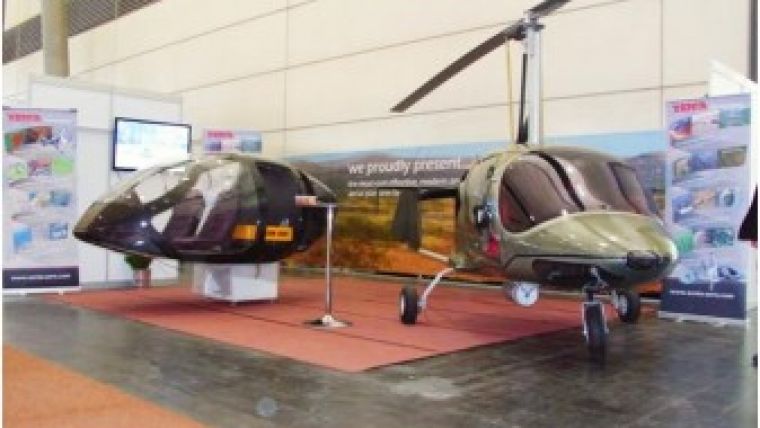
On Intergeo 2012 in Hanover the carbon-monocoque of the new designed machine with a weigt of just 22,5 kg was presented to the most interested clientele. According to the information of exhibition host HINTE, DiNelly had the most popular stand, visitors were impressed by the possibilities there are now concerning space volume and compatibility of systems by installing the actually largest mount of Somag, laser scanner of RIEGL and photogrammetric cams of VisionMap in the chassis of the new DiNelly Gyrocopter. The target was to get the feedback of users and producers of systems to optimise the aircraft before receiving the type certification in a few weeks. A very positive feedback was created by the low costs of operation per flight hour and the low annual maintenance costs. Thereby DiNelly Aerosystems has met the expectations on a significant more efficient platform for airborne data acquisition.

Value staying current with geomatics?
Stay on the map with our expertly curated newsletters.
We provide educational insights, industry updates, and inspiring stories to help you learn, grow, and reach your full potential in your field. Don't miss out - subscribe today and ensure you're always informed, educated, and inspired.
Choose your newsletter(s)


