HERE Launches Global Lidar Data Library for 3D Modelling Applications
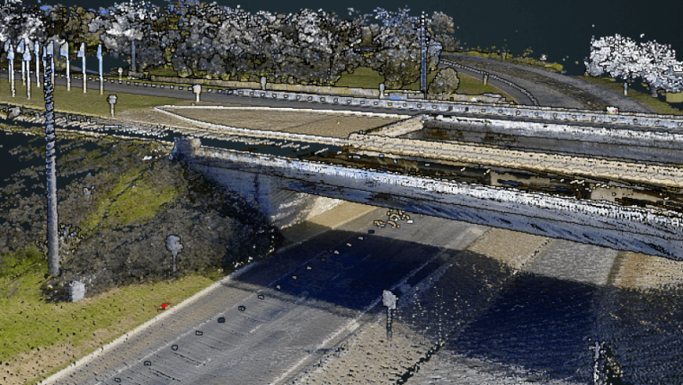
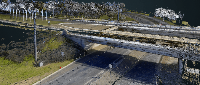
HERE Technologies' global library of 3D Lidar data is now available on the company's location data and technology platform. HERE Lidar Data captures millions of kilometres of roadways and their surroundings in high-fidelity across more than 50 countries and territories.
Lidar data delivers powerful 3D modelling capabilities that enable digital twin representations of reality. HERE Lidar Data enables users to create a digital twin representation of reality with the identification, classification and localization of objects within +/- 2 centimetres of relative accuracy within the Lidar point clouds.
HERE Lidar Data supports a colourized feature that infuses each point with an RGB value for improved visual contrast of real-world objects within the point cloud.
Geospatial data, BIM and 5G
HERE Lidar Data use case examples across the public and private sectors show that the applications are wide-ranging. Public-sector departments and transportation agencies can access highly precise geospatial data for virtualized infrastructure asset management, road network planning, traffic congestion analysis and federal reporting requirements.
Engineering, architecture and design firms can receive unparalleled datasets to perform site selection analysis and design impact simulations, with HERE Lidar Data easily integrating with Building Information Modelling (BIM) software.
Energy utilities and telecommunications companies can conduct centralized pole/wire inventory management and assessment. Lidar data provides the telecommunications industry with the 3D map data used to optimize 5G network planning and design.
Lidar 3D point clouds as foundational data
“HERE is excited to offer customers across the public and private sectors simplified access to this powerful dataset,” said Jørgen Behrens, chief product officer at HERE Technologies. “Users can request HERE Lidar Data-as-a-Service, or they can access the company’s global library of 3D point clouds via the HERE Platform. Our goal is to help decrease the time and cost associated with commissioning traditional data collection surveys.”
HERE captures the world’s road networks and urban environments from hundreds of data sources, including its fleet of Lidar sensor and 360° camera-equipped vehicles. HERE utilizes the Lidar 3D point clouds as a foundational data source for the company’s various 3D and HD map content products.
At CES 2022, HERE will highlight the capabilities of HERE Lidar Data in conjunction with its partner discussion with Bentley Systems. Enterprises and professionals can leverage HERE Lidar Data using Bentley’s Orbit 3DM, a cloud-based visualization software solution, to design, build and operate infrastructure more efficiently, reducing site visits and data collection time while accelerating project design and construction time.

Value staying current with geomatics?
Stay on the map with our expertly curated newsletters.
We provide educational insights, industry updates, and inspiring stories to help you learn, grow, and reach your full potential in your field. Don't miss out - subscribe today and ensure you're always informed, educated, and inspired.
Choose your newsletter(s)


