High-Resolution Satellite Imagery on TV
DigitalGlobe has provided NBC's "TODAY" show with access to its extensive library of advanced satellite imagery and to its 3D ImageScape product for the second edition of the "Today Goes to the Ends of the Earth" project.
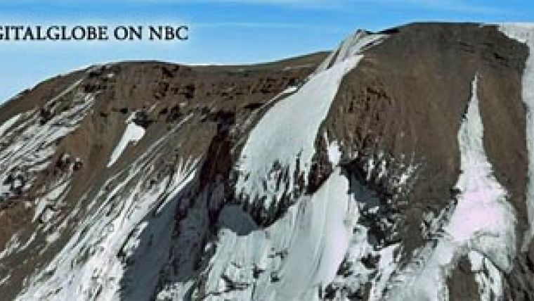
Launched last year as part of NBC Universal's "Green is Universal" initiative, "Ends of the Earth" will use ImageScape, a 3D image product created as a result of DigitalGlobe and AEgis Technologies partnership to transport "TODAY" show viewers to this season's identified locations: Africa's highest peak, Mount Kilimanjaro, the capital city closest to the Arctic Circle, Reykjavik (Iceland), the longest coral reef in the Western Hemisphere off the coast of Belize, and the draught occurring in Australia. The project, which first aired on Monday 17 November 2008, was created in an effort to raise awareness about environmental issues and climate changes across the globe.
NBC's use of DigitalGlobe's collection of current and historical sub-metre earth imagery signifies the increasing demand for high-resolution satellite and aerial imagery, and the expansion of this technology into industries beyond location-based services, such as television entertainment, broadcast media, online Web portals, and social networking.

Value staying current with geomatics?
Stay on the map with our expertly curated newsletters.
We provide educational insights, industry updates, and inspiring stories to help you learn, grow, and reach your full potential in your field. Don't miss out - subscribe today and ensure you're always informed, educated, and inspired.
Choose your newsletter(s)


