Higher-resolution Satellite Imagery for Global Applications
European Space Imaging is now able to supply 30cm imagery from the WorldView-3 satellite for European and North African customers wishing to use the most sophisticated very-high-resolution satellite imagery on the market. This is made possible through its partnership with DigitalGlobe and the WorldView Global Alliance.
Access to the world’s highest-resolution commercial satellite imagery captured by WorldView-3 satellite will improve decision-making, enable more efficient operations, and enhance a variety of applications for customers in the civil government, defence and intelligence, energy, mining, and global development sectors, European Space Imaging stated.
Many customers who were previously reliant on aerial imagery can now benefit from the improved economics, global availability, and faster refresh rate that European Space Imaging can provide with its 30cm satellite imagery. The 30cm imagery products are also a rapid and affordable alternative in locations where aerial imagery is readily available.
Applications
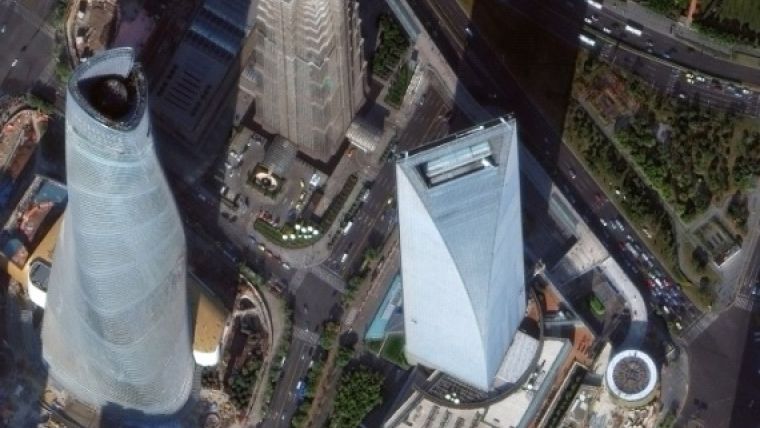
The suitability of 30cm satellite imagery for aerial imaging applications is confirmed by the National Imagery Interpretability Rating Scale (NIIRS), which is used by the imaging community to define and measure the quality of images and performance of imaging systems. DigitalGlobe’s 30cm imagery achieves a rating of NIIRS 5.7, meaning it can resolve objects on the ground such as above-ground utility lines in a residential neighbourhood, manhole covers, building vents, fire hydrants, and individual seams on locomotives.
The satellite also features shortwave infrared (SWIR) capabilities that will enable new applications such as seeing through smoke and haze, identifying minerals and man-made materials, and assessing the health of crops and vegetation.
Companies should be exploiting the competitive advantages of the WorldView-3 data to look for potential ore-related alteration that will have been missed by the previous satellites used for alteration mapping, said Dan Taranik, managing director of Exploration Mapping Group, a service provider to the global mineral exploration industry. Detailed inspection of remote areas on the peripheries of alluvium or younger volcanics would be a competitive advantage that could help reveal concealed deposits, he added.
Image courtesy: DigitalGlobe.

Value staying current with geomatics?
Stay on the map with our expertly curated newsletters.
We provide educational insights, industry updates, and inspiring stories to help you learn, grow, and reach your full potential in your field. Don't miss out - subscribe today and ensure you're always informed, educated, and inspired.
Choose your newsletter(s)


