Historic England Releases Map Based on Half a Million Aerial Pictures
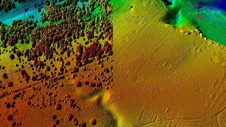
More than 500,000 aerial images of historical sites in England have been used for a new mapping tool. Photographs and 3D laser scans taken over the past 30 years have uncovered "hidden archaeological landscapes", Historic England said.
Sites include 6,000-year-old long barrows, Roman camps such as those on Hadrian's Wall and 20th-century areas linked to the two world wars. The map covers more than half of the country. Duncan Wilson, chief executive of Historic England, said: "This new aerial archaeology mapping tool lets people fly virtually over England and drink in its many layers of history."
"We hope it will give people a springboard to further investigation, whether for research purposes or simply to satisfy curiosity about what archaeological features they may have noticed around their local area."
Historic England has highlighted eight examples of "hidden history" unearthed by aerial mapping.
Read the full story at bbc.com.
Source: BBC.

Value staying current with geomatics?
Stay on the map with our expertly curated newsletters.
We provide educational insights, industry updates, and inspiring stories to help you learn, grow, and reach your full potential in your field. Don't miss out - subscribe today and ensure you're always informed, educated, and inspired.
Choose your newsletter(s)


