How Geospatial Technology is Vital for Exploring Mars
Courtesy of the USGS Astrogeology Science Center, NASA’s Perseverance rover was equipped with some of the most precise maps of Mars ever created when it landed on the planet in February 2021. Not only were these new maps essential for a safe landing on Mars, but they also serve as the foundation upon which the science activities planned for the Mars mission will be built.
In order to safely land on the rugged Martian landscape, the spacecraft used a new technology called Terrain Relative Navigation. As it descended through the planet’s atmosphere, the spacecraft used its onboard maps to know precisely where it is and to avoid hazards. For the navigation to work, the spacecraft needed the best possible maps of the landing site and surrounding terrain.
Two USGS-developed Mars maps
The USGS developed two new maps for the Mars mission. The first is a high-resolution (25cm per pixel) map that researchers have used to accurately map surface hazards at the landing site. This map serves as the base map for mission operations and to plot where the rover will explore after landing. The second map is a lower resolution (6m per pixel) map that spans the landing site and much of the surrounding terrain. This was used onboard the spacecraft, along with the locations of the hazards from the high-resolution map, to help it land safely. The maps have been aligned with unprecedented precision to each other and to global maps of Mars to ensure that the maps show the hazards exactly where they really are. Both new maps are available here.
NASA used remote sensing technology to decide between 30 potential landing sites for the Mars Perseverance Rover Mission. The two maps are based on images collected by the Mars Reconnaissance Orbiter’s Context Camera and the High-Resolution Imaging Science Experiment (HiRISE) camera. After intense scrutiny of the sites, they decided to select Jezero, a 49km crater in the Syrtis Major quadrangle on Mars, as the landing site.
The role of remote sensing data
The landing site for Perseverance had to fit four main criteria: the site had to be geologically diverse, showing signs of the processes that formed it; the location had to be astrobiologically interesting, with signs of possible ancient life; there should be enough suitable material at the site for collection and caching for possible future pick-up; and the site should contribute new knowledge that will help humans go to Mars. Read here about a project that compared attributes of three of the final contenders for the Perseverance/Mars landing site and shows how the data acquired by the remote sensing equipment aboard the MRO helped make the final decision.
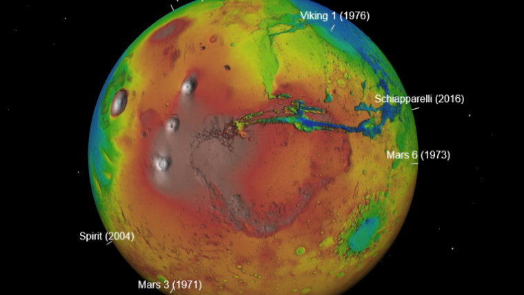
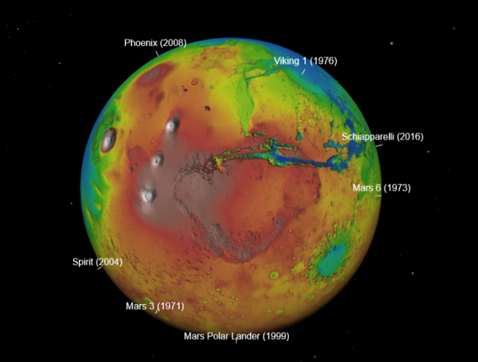
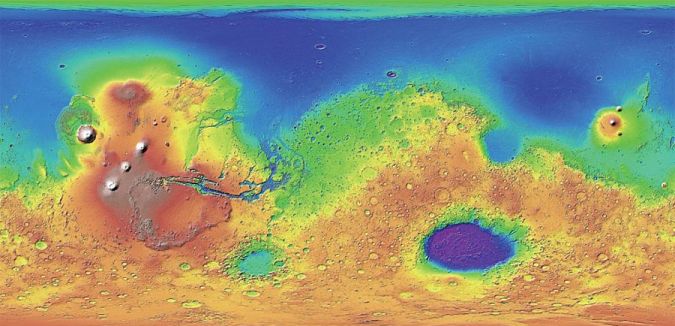
Explore Mars with GIS
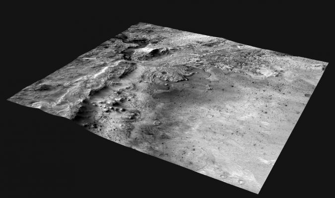
Esri recently developed the ability to use other planetary coordinate systems with a 3D globe, and the timing could actually not be better as we just witnessed the successful landing of the Perseverance rover. Digital elevation models, precise imagery and spatial data representing previous rover landing sites all display accurately under the Martian coordinate system, it all can be explored with the Explore Mars app. (text continues below image)
In anticipation of future missions to Mars, GIS techniques already have been applied to previously collected elevation data from Mars to model the terrain to aid rovers and, eventually, humans. The National Aeronautics and Space Administration (NASA) created digital elevation models (DEMs) from data provided by the Mars Orbiter Laser Altimeter (MOLA), an instrument on its Mars Global Surveyor spacecraft (1997 to 2001). Digital terrain models (DTMs) have been produced from the above mentioned HiRISE camera on board the Mars Reconnaissance Orbiter that has been collecting data since 2006.
“Our understanding of the planets in our solar system, as well as exoplanets, will begin to increase exponentially. At the same time, we will continue to apply the remote-sensing/GIS processes that we develop for Earth to planetary environments where applicable. Especially for a planet like Mars, where it is likely humans will be taking field measurements within the next 15-20 years, a unique opportunity for planetary image data verification will develop. It will allow us to better interpret the imagery we collect and improve the geospatial models we create for interplanetary study, and I think that’s very exciting," François Smith, geospatial data scientist at MDA Information Systems LLC in Gaithersburg, Maryland, already stated back in 2017.
This news article is based on content obtained from Esri, USGS and NASA.

Value staying current with geomatics?
Stay on the map with our expertly curated newsletters.
We provide educational insights, industry updates, and inspiring stories to help you learn, grow, and reach your full potential in your field. Don't miss out - subscribe today and ensure you're always informed, educated, and inspired.
Choose your newsletter(s)


